Showing posts with label Hardwood Island. Show all posts

Sunday, January 19, 2014

Hardwood Island

A few days ago, we had another warm, calm day for January, and though we had plenty of work to keep us ashore, decided to get out for a bit. We launched by noon, which gave us over four hours before darkness. Despite the lack of wind, the remnants of previous days’ winds continued in the form of swell coming in from the southwest, hardly noticeable in the harbor, but gradually increasing as we made our way south. 
-->


As we often do, we headed first to Steves Island. Rebecca checked things out on shore while I circled the island. It occurred to us that during the previous night it had hardly dropped below freezing, and it would have been comfortable enough weather to camp out. Off course, the nights are still long.


We headed across Merchant Row, and followed shorelines: Harbor, Merchant, Ewe, Hardwood. I had it in mind to stop on Ram Island for a break, but the seals had claimed it and were piled high on surrounding ledges. The south end of Hardwood Island, where we sometimes like to meander among the partially submerged boulders, was turning the moderate swell into some large breaking waves. We went around to the less active side and landed on the rockweed.


The south shore of Hardwood is sprinkled with good boulders upon which to perch, sip some hot cocoa and watch the waves come in. The sky began to cloud over, and though there was hardly any ice or show on shore to indicate the season, those icy clouds casting a halo around the sun have a distinct wintery look.


We followed Merchant Island's south shore, enjoying the gentle side to side wavy motion, with an occasionally bigger wave to keep it a little lively. By the time we reached the west end, with sunset imminent, we had to stop our dilly-dallying and head back.


The sunset saturated the sky over Penobscot Bay as we made our way below the bluffs on George Head, and across to Sand and Crotch Islands where the granite crane made a black profile against the pink sky. A couple of lobster boats came motoring along behind us. It had been a nice day and most of the boats had gone out, so there would be many more as it turned dark. We hurried across the Thorofare, back to the launch.


Saturday, September 8, 2012

Freshmen


Before each academic year, College of the Atlantic offers an orientation trip to their incoming freshmen. These trips range from hiking on the AT, canoeing on the Allagash, sailing and - of course, sea kayaking. Mel  (former co-proprietor of Bar Harbor’s Carpe Diem Sea Kayaking) and I would each take a group - seven students and two student leaders in three tandems and three singles- from Stonington to Mount Desert Island. Her group favored a more sheltered northern route around MDI. The student leaders in my group, veterans of Patagonian sea kayaking with NOLS and teaching sea kayaking to kids at Rippleffect, hoped to lead our group around the wilder and more exposed southern end of MDI. Of course, everything would depend on the weather and the group.


We met Monday morning at Old Quarry and spent the afternoon practicing rescues in the pond. In between learning to pack gear, setting-up tents and making meals, the groups circled-up often, getting to know each other. That was the real point of the trip. The fireworks that erupted that night over Stonington Harbor (they followed the Flash! In The Pans performance at the Fish Pier) seemed appropriate somehow. This was a significant time for these students. For some, that night was the first they had ever been camping.


On Tuesday morning as waves of rain and fog swept through, we packed boats and launched.  The sky gradually cleared, but as we stopped for lunch on Saddleback Island, we had our eyes on tall ominous clouds growing in the western sky. Since the next day’s forecast called for strong winds, we’d decided to get across Jericho Bay while the getting was good. It wasn’t good for long; just as we started pulling our boats into the water, thunder rumbled in the west. We all looked at each other and I said “We’re staying here.” It pays to make lunch stops on potential camping islands.


We got camp set-up and the storm came through - not too bad, but had we left it would have caught us out in the middle of Jericho Bay. Everyone seemed content to be on Saddleback, especially as the sun came-out. Some of us hiked around the island. Later, we sat on the sloping granite slabs and ate dinner as the sun set and lights came on in Stonington.


We made our way to Bar Harbor over the next four days. We faced plenty of wind and waves as well as seasickness and other ailments, but the students’ spirits remained high, and they were patient - good at helping each other over the tough spots. They didn’t seem to care much where the route took us; it was all good. We camped at Hog Island, off Naskeag Point and on to Hardwood Island, where the owners gave us permission to camp above the beach. With forecasts looming for ever-increasing wind, our route shifted to the north side of MDI, and we made our way up through Bartlett Narrows and beneath the bridge to our last evening’s destination, Thomas Island.


We often played games as we paddled: “if you were a pirate ship, what weapon would you choose?” After everyone else had chosen deck-mounted machine guns or light sabers or whatever, I said I was a pacifist, just because my mind was on other things. We were, after all, in the middle of crossing Blue Hill Bay, with the tide picking-up against the wind, the waves growing steeper, and I really just wanted to get the group across. Of course, part of their goal was to distract their seasick friend.


One thing I like about teaching and guiding is seeing improvement- a change in people’s skills and confidence. This comes in many forms. The students who could barely make progress against the wind on Tuesday focused on their form, and by the end of the week had better forward strokes. On that last evening I vowed to myself to not nag about moving the boats above the high tide line. I wasn’t going to let the boats drift away on one of the highest tides of the month, but it was time for someone else to take charge, and sure enough, they did, pulling the boats up and tying them off to a tree. Some students took extra trips with me in the late afternoons, and it seemed clear that they’d discovered something that they might stick with.


On the last evening, the full moon shone on Cadillac Mountain, where headlights occasionally poked through the night. We finished dinner and sat around a candle. That pirate ship question came back again, and I was encouraged to choose a weapon. I thought about the sci-fi television I’d seen lately and the answer just came-out: “an FTL drive.” After a moment’s silence, someone said “a faster than light drive... not bad.” I felt I’d passed a test. 


On the last morning, I suggested to the student leaders that they could take charge on the water and I’d hang-back a bit. The directions were straightforward enough: keep Mount Desert Island on your right for about eight miles until you see Bar Harbor.


We paddled straight lines far from shore- the most direct route to get us there. At Hadley Point we ran into the other group- they were heading-out for a day in the Porcupines. I suggested to my group that if anyone wanted to, we could check-out the Porcupines as well, but they seemed focused on the destination: the comforts of their new dorm rooms- flush toilets, television and computers. For miles, we paddled along while the students played games. Gandalf or that wizard from Harry Potter? Beatles or Rolling Stones (I woke up for that one- the sole Stones supporter). On and on. Nautical miles had been replaced by highway miles, and the games made them go past. I pulled into the caves at the Ovens- spectacular cliffs dropping directly into the sea- and the group kept paddling, getting far ahead without once glancing back to see if they still had a guide.


But it felt good to round the corner into Frenchman Bay and to see the Porcupines spread-out to the south. The predicted strong winds peaked before we launched, and the rest of the day looked relatively mellow. We passed Hulls Cove and a few big old houses on our way into Bar Harbor- passed the old ferry dock, and there it was: College of the Atlantic with its steel pier and a little beach just waiting for us. One by one we landed, and began unpacking boats. 

I thought I would accept a ride back to Stonington, but my boat sat near the water’s edge, ready, too much to resist. At mid-day, I still had hours to get to a campsite that night, and I could take all of Sunday to get back home to Stonington. I got rid of my garbage, topped-off my water, accepted a gift of some leftover chocolate (very much appreciated) and said my goodbyes. Then I paddled back to Stonington. Another story.


Tuesday, September 28, 2010

Kimball Head


Yesterday the winds came from the southeast, so Nate and I thought it would be a good day to spend some time in the lee of Isle au Haut, paddling around Kimball Island. It was getting toward high tide as we paddled out, pausing for awhile among the boulders off Hardwood Island. At that point, the seas were fairly calm, with only an occasional small swell rolling in among the boulders: good conditions to practice without the consequences that bigger waves bring with them. The boulders offer a maze of pathways. You can glide into one and quickly shift direction as other avenues present themselves. Sometimes a small wave breaks and you need to choose to either ride it out, turn into it, or risk getting pushed sideways, probably into a rock. We tend to spend a lot of time doing some fairly extreme edging to make tight turns.


We took a quick break when we arrived at Kimball Island, then headed around Kimball Head. For the most part, the seas were still fairly calm, but it doesn’t take much to make things interesting among the rocks. We found a small wave that we surfed in a few times, always ending with a 90-degree turn at the end of the ride, just before the wave hit the rocky shore. We backed into a few slots, and basically just paddled around, looking for trouble. Nate demonstrated the fine line between rock gardening and “amphibious paddling” when he frequently ended up on a ledge with no water beneath his hull. This continued on around to Marsh Head, just before we headed north through the Isle au Haut Thorofare.


Of course we were having fun and stayed out there longer than we should have. Nate had parental duties to get to at home, so the last five or six miles were fairly straightforward “let’s get home” paddling with a 15-knot beam wind. We wished we could have temporarily transformed our boats into long, straight racing craft to make the slog a bit quicker, but given the choice, we’d still go for our sporty, turny craft most days, since they take us into places that longer boats just can’t go. It started raining before we arrived back at the ramp- a cool, soaking rain, which only seemed to immerse us in the elements that much more.

Sunday, November 8, 2009

Going Out For Indian Food

We almost went camping tonight. The impulse came a little late in the day though, and then it occurred to us that we’d have two hours of daylight, followed by fourteen hours of darkness. And as nice as it is to hang-out in a tent off on an island for the six or so hours you’re not sleeping... we changed our minds. If we had gone, I’m sure I could have gone on about how nice it is in the dark with the sounds of waves crashing on the granite. But this couch is also nice, as is the reggae in the background, and the miracle of electricity and all the other magic that allows me to post this to you.


Between the short days and the usually sketchy weather we get this time of year, it takes some effort to get out there. Rebecca and I had a good trip yesterday, out among the islands west of the archipelago: Mark, Scraggy, Sparrow, Ram, Hardwood. It’s a fun loop- eight or nine miles of fairly evenly-spaced islands along the edge of Penobscot Bay. We took a break on the ledge on the south side of Mark Island, which was sunny and warm, just out of the wind. We were feeling kind of lazy, and once we kicked-back on the warm granite, could have easily stayed all afternoon.


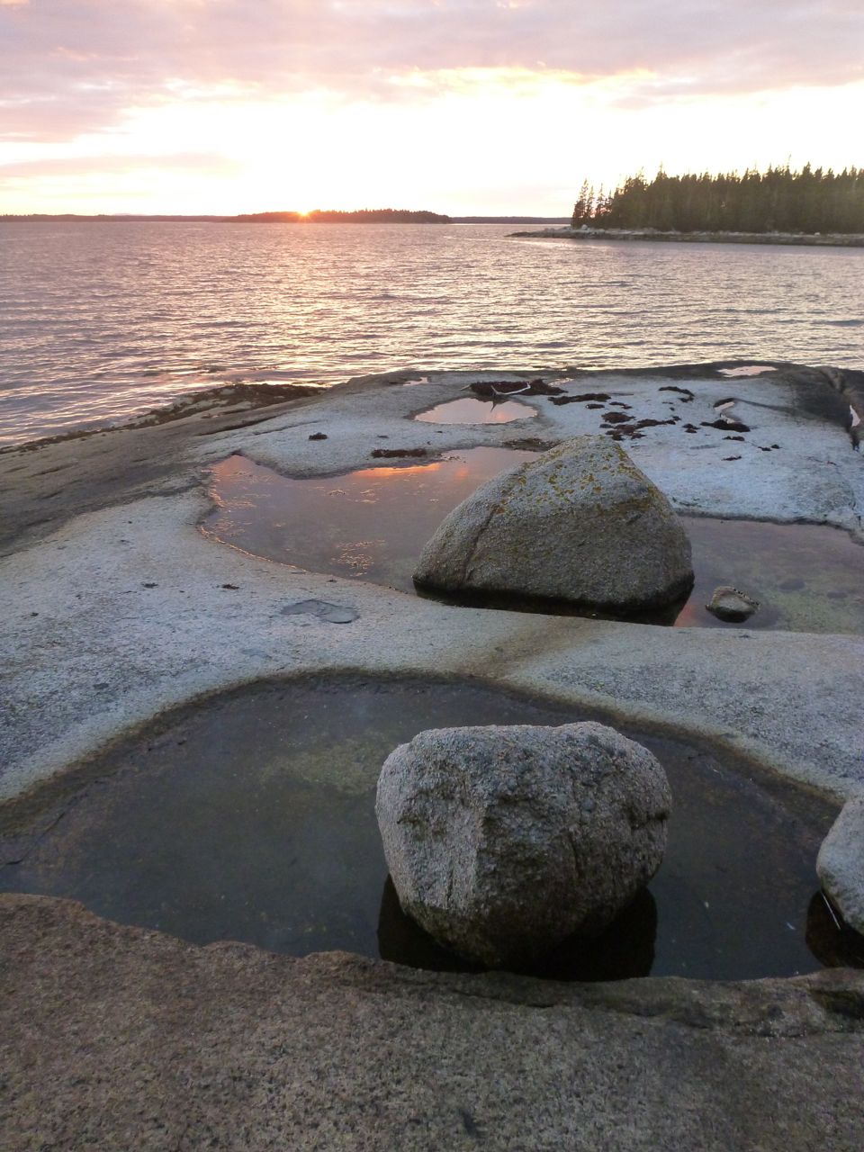
I often like stopping at Sparrow Island in the winter when the birds aren’t nesting there, but the high tide had completely submerged the beach. We went on toward Ram, paddling in beam waves, thinking about lunch. But the landing on Ram was in the shade, and the sunlight seemed to be directing us to the boulder-strewn southern ledges of Hardwood Island. I hadn’t landed on Hardwood for a couple of years (and I’m not sure who owns it) but I remembered the steep granite slab sloping down into the ocean and a playground of glacial erratic boulders.


Those boulders are fun to paddle among, especially with a gentle swell from the southwest, but they’re also a good place to pull your boat up, get out the stove and heat up some instant Indian food for lunch. When we say we’re going out for Indian food, this is usually what we mean. And when I say lunch, I mean that meal that happens just before sunset (4:15) which seems to take us by surprise every time. We arrived back after dark.


I have an article in the December issue of Sea Kayaker: "Meandering in Maine: Paddling the Stonington - Isle au Haut Archipelago." It's a destination article, with plenty of information about paddling in this area, as well as a section on paddling among lobster boats. If I do say so myself, it's a nice, concise guide to basic paddling here. I hope you get a chance to check it out!