Showing posts with label Cranberry Islands. Show all posts

Tuesday, August 2, 2016

Cranberry Islands Figure-8


Occasionally someone asks me if sea kayak guiding is fun, and I shrug and say “most of the time.” Like any job, some days are better than others. But some days are even better, more like going for a paddle with a friend or two. It helps sometimes if I get to paddle someplace where I don’t get to go every day. It also helps if I like hanging-out with the people I’m guiding or teaching.


On a previous trip, J had been out to the Porcupine Islands and this time wanted to do something around the southern end of Mount Desert Island. The weather was warm and perfect, so for this trip through Acadia Park Kayak Tours, we met at the launch in Northeast Harbor and headed out of the harbor, where I felt pleasantly distracted by the sensual curves and gleaming varnish of the well-kept boats drifting on their moorings. Some of those boats are called, I think, ‘picnic boats’, and it says a lot about the idyllic lifestyle that goes with them – to have such a beautiful (and pricey) vessel meant only to take you out on picnics. But we had our own picnic boats, and a whole day out among the islands ahead of us.


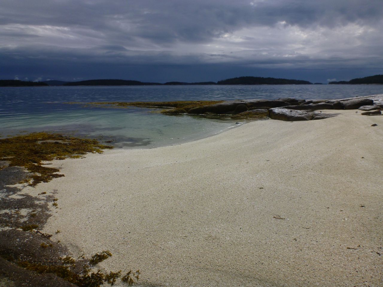
We paused below the lighthouse on Bear Island and crossed over to the giant osprey nest near the west end of Sutton Island. We had talked about following the shore of Sutton and taking the shortest crossing over to Little Cranberry, but J was paddling well and the day felt calm and warm, with only a handful of powerboats out to worry us on our crossings. So we headed straight across to Great Cranberry and followed the western shore, which feels mostly undeveloped despite a few homes tucked into the trees. At the south end, the open ocean lay before us with the Duck Islands appearing closer than they really were, nearly four miles south. Swell rolled-in toward the rocky shore, lifting us before it broke into white waves over the ledges, and I watched J to make sure she was comfortable; she wore a huge smile and said she loved it.


We took a break and checked out the MITA island and the view of the MDI mountains rising over the Cranberries. It’s one of those views that is a bit stunning at first and you keep taking pictures and staring, just trying to take it in. I thought about the last time I’d camped there – it’s been a couple of years – and promised myself to get back and camp there again before long, since you almost need to sit there for a long, quiet period to take-in such a magnificent landscape.


We switched boats – J wanted to learn to maneuver better, so I took the Tsunami and she took my Cetus. Again, her smile was almost immediate, as if she’d been let in on a big kayaking secret (yes, those boats and paddles are worth every penny). I’ll admit that I often take good kayak design a bit for granted, since I generally paddle nice P&H kayaks (I mostly paddle a Scorpio at Old Quarry). And when I hear paddlers blaming the boat for their own inability, I tend to take it with a grain of salt – the boat is usually a small part of the equation, especially when we’re comparing kayaks with similar designs that were meant to be paddled without a rudder. But if I’d started with a big plastic ruddered boat with a pronounced keel, I think I would have either needed to switch to something more maneuverable, or I wouldn’t have progressed as a paddler. And perhaps this is why a lot of paddlers find it hard to get out of the “point A to point B” mode and discover the pure joy of tooling along a shore, maneuvering the boat as if we’d morphed into more aquatic creatures.


We headed north through The Gut and pulled-in at the beach beside the town landing. We’d hoped to eat lunch at the Islesford DockRestaurant, but sadly it’s closed Mondays and Tuesdays, so we had more usual fare (pb&j) on the beach. The restaurant is in its last season, and I’ve never eaten there… it seems that everywhere I go I come up with reasons to return – soon.


Having gone around Great Cranberry, it seemed a good idea to now head around Little Cranberry, which we did, paddling along the northern shore where some fine old “camps” have stunning views of MDI. It’s tough not to think that jeez, maybe when we sell the foreign rights and the film rights to the guidebook, maybe I can buy one of these places… and a picnic boat or two with matching colors. But I didn’t ponder my color choices for long, since I’d been watching for thunderstorms, and now some very major, dark clouds began gathering over Mount Desert Island.


We kept an eye on the clouds as we proceeded around the island, cataloguing the places where we might get out to seek shelter. The clouds stayed north until we were headed to the lighthouse on Baker Island and the storm clouds began pushing-out through the mouth of Frenchman Bay, rolling toward us. We turned back and settled for a Figure-8 around the two big Cranberries.


We were getting tired by then anyway. Or at least I was. I kept watching J for signs of fatigue that never seemed to materialize. By the time we landed back in Northeast Harbor we’d paddled nearly sixteen nautical miles – farther than most of my guided day trips. We’d had the tidal current with us most of the time, and a couple of miles might have been augmented by our fear of thunderstorms, but still, not bad.

If I had the time (or if anyone did, for that matter) it would be fun to systematically go through my guidebook and paddle all fifty routes. I am working on paddling them all again, but my approach is a bit more haphazard, mostly dependent on where I get to guide and teach people (perhaps in a month or two when things slow down I’ll get to choose paddling excursions a little more selfishly). But this was yet another approach to Route #10 in my guidebook, AMC’s Best Sea Kayaking in New England.

Monday, April 18, 2016

The Cranberry Islands

--> -->

Although we’d been getting out paddling fairly regularly for the past months, it had been awhile since we’d been-out for a full-day trip. And now that the guidebook is out, I’ve had an urge to use it as a reference to go back and paddle all fifty of those routes again. In the best of circumstances – no other commitments, perfect weather, places to stay and not too much time spent driving – it would take at least two months to paddle all the routes again, so it may take me awhile to get around to them all, since my schedule seems to be getting filled.


Sunday morning was a perfect time to get started though, having spent a night after a nearby Bar Harbor pool session in Lisa and Gordo’s posh travel trailer. We’d arrived and found a chart and the guidebook on the kitchen table, along with one of the most important route-planning tools – a piece of string for measuring out distances. We settled on a trip out to the Cranberry Islands, and right away we found a mistake in the distance info that referenced the “Little Cranberry Island launch,” which should have read “Northeast Harbor.” Ugh. Frank came down from New Brunswick and after Barb joined us for a pancake breakfast, we launched late in the morning from Northeast Harbor. 


In the guidebook’s introduction, I made a point that despite the solid-looking line over the water in the route descriptions, paddlers need to make their own choices. I’m aware that some paddlers tend to get their eye on a distant goal, focusing on the most direct way to get there. I’m more prone to keep that destination in mind while focusing on whatever shore I’m passing along, and I zig-zag, making perpendicular channel crossings and following shorelines for as long as possible, rather than making big, open-water diagonals. In fact, I’ve outlined the pros and cons of these approaches in an essay in the guidebook called The Merits of Following the Shore. Aside from the obvious safety and courtesy factors of avoiding channels used by bigger boats, and the proximity of bailouts, near-shore paddling just seems more interesting to me, and it usually adds less distance than one would think. I doubt I would have much passion for simply getting from point A to B in a kayak. Those are highway miles, counting down the distance to the next exit; it’s all in the journey. 


We found plenty of cool stuff along the shore, from the massive osprey nest on Sutton Island and the enticing turn-of-the-century summer homes, to a few spots where small waves rolled in and provided a challenge or two among the rocks. We stopped briefly in Islesford on Little Cranberry, where most of the shoreside homes are still shuttered, but a few lobster fishermen were busy on the dock. We continued around to the beach on the south side and ate lunch while low tide came and went.

The day felt warm, and after a couple of sandwiches and some hot cocoa I felt almost more inclined to lie back and see what sun I might soak-in through my drysuit. But while we ate we’d been watching the various areas where the small swells erupted in white turbulence, and wondered what sort of waves we might find around the next ledges. 


In the past, Rebecca and I had lucked upon some very small, gentle waves that gave us long, easy rides. There are enough variables – mostly swell size and direction, as well as tide height – that it’s tough to predict what you’ll find. 


The waves were small enough to be almost imperceptible from a distance, but once among them, we started catching those long, easy rides. The sea floor there is very gradual, and the open ocean impact is muffled some by further-out ledges, so these waves were small and nicely shaped. You could catch them with a stroke or two at take-off, and if you kept your speed slow enough that your stern hung back over the crest, you could make turns on them all the way into the beach, sometimes falling off the back only to be picked-up by the next one. The water, of course, is still only about 40 degrees, so we all got our share of invigorating wake-up splashes, if not a dunk or two. 


We’d hoped to go-on to see the lighthouse on Baker Island, but we’d launched late and found some features along the way that burned both time and energy. We found it difficult to leave the surf, but decided that we should head back. Besides, brownies and ice cream were waiting back at the house, and there was much to enjoy along the shores of the islands on our way back.

Tuesday, July 30, 2013

The Cranberry Islands


Despite our Tuesday through Sunday gallery hours, it's tough for Rebecca and I to close on a mid-summer Monday for a day off together. Our busy season is short, and the winter is long, with just as many bills. We usually look out at the people walking down Main Street and imagine it in a few months time, when the crowds thin and the paddling is at least as good, and we choose to work rather than play. But it is possible to sneak away early in the day for a paddle and just not think about all the money we're not making. That's how Rebecca and I found ourselves in the Cranberry Islands last Monday.


We launched in Manset and headed out to Great Cranberry Island, where we arrived at high tide-- in time to explore The Pool, a large tidal basin on Great Cranberry's east side.


We ate lunch on a MITA island and went on to Little Cranberry, where we played for a bit in the one-foot surf along the southern beach.  If the waves roll in just so, it hardly matters how big they are-- you can still catch a nice ride. The trick is staying on the wave, not getting ahead of it. We rode them in again and again. Finally, as the tide fell, the wave shape changed and they became harder to catch. Time to move on.


On to Baker Island, where we took a walk up to see the lighthouse and the remains of the community that existed there long ago.


We headed back around the south end of Great Cranberry and north through the Western Way with the current behind us. It's so much better to end a trip with the current behind you. It left us with just enough energy, as the sun began to set, to dawdle a bit in Southwest Harbor so Rebecca could photograph some of the boats. Not a bad way to end a long day off.

The next day I discovered that Nate and I are on the cover of the August issue of Maine magazine (see "Guides Class" from May 12). In the photo, we're having dinner with students and guests on our guides class camping trip. We're silhouetted by the sunset, but trust me, it's us. There's a nice article on the inside too-- even mentions this blog. Thanks to writer Sandy Lang and photographer Peter Frank Edwards.

Here's a video from the Cranberry Islands:


Wednesday, September 12, 2012

Paddling Home


There I was... boat all packed and ready to go on the beach in Bar Harbor. The students I’d guided all week were busy shuttling gear away from the beach, arranging big piles of drybags. I said quick goodbyes and slipped away, heading south. We'd come eight miles from Thomas Island on the north side of Mount Desert Island. Now I paddled toward a private MITA island just off of Great Cranberry, about twelve miles around the southeast side of Mount Desert Island.


Gliding past the Bar Harbor waterfront, I felt cut-loose, a little strange to be paddling alone; I could paddle any speed I wanted and not look back. Just past the breakwater at Bald Porcupine, I pulled into Compass Harbor and took a break on Dorr Point. Site of the former home of "Father of Acadia" George Dorr, the point is now part of the National Park and is a good spot for a breather before the next stretch, in which easy landings are scarce.


The coastline from Compass Cove to the southern end of MDI is a playground of rocks and ledges stretching five miles past sheer cliffs, undercut sea caves and towering rocky slots. Alone in my loaded boat with miles to go, I paddled conservatively, occasionally nosing into a slot or a cobble-beached cave... the sort of paddling that elicits constant wonderment, but also the sense that I haven't spent nearly enough time here and would need to return for more. I passed only two kayaks- a tandem and a single paddled by shirtless guys and a woman in a bathing suit- no life jackets- who appeared well out of their element in the minor swell. Just north of Schooner Head the private homes give way to the wild shoreline of Acadia National Park, and the people on shore begin; walking the trails, hanging-out on rocks (some literally hanging from ropes). After Schooner Head, Labor Day weekend visitors dotted Sand Beach and the stretch of granite shoreline from there to Otter Point. Happy to be alone, I stayed just far enough from shore to inhibit attempts at conversation.


Just west of Otter Cove, I pulled into a slot and landed on a cobble beach for a quick break before heading across to Little Cranberry Island. At the edge of the harbor I waited as several boats arrived, some driven by captains in blue blazers and khakis- arriving for the Islesford Dock restaurant's last night of the season. A little more paddling brought me to my campsite for the night.


A couple of other tents were set-up in the grass, but their occupants were absent. I carried my boat up past the tide line and set-up on a rocky ledge, eating my dinner as the sun went down and the full moon came up. A pair of kayaks appeared in silhouette, arriving from Little Cranberry. I met the paddlers later and we talked for awhile as it grew dark and the moon rose. They had come here on a whim, one from Portland, the other from Bath. They'd eaten dinner at the Islesford Dock restaurant, and planned on a leisurely Sunday. Again, headlights of cars snaked up the dark profile of Cadillac Mountain. With the fly off my tent, I slept in the moonlight, the barking of distant seals mingling with my dreams. Still in my sleeping bag, I watched the sun rise.


I had about twenty miles of paddling between me and Stonington, but I lingered over breakfast, enjoying the view of clouds easing through the hills on MDI. The sunshine lasted for a couple of hours, fading as I passed Great Gott Island and the Bass Harbor Head lighthouse. By the time I took a break on Placentia, a breeze picked-up, accompanied by intermittent rain.


Just before mid-day, I left the northwest corner of Placentia and pointed toward North Point on Swans Island. Despite the tide being nearly high and slack, the incoming current swirled back on itself as it squeezed into the mile-wide gap between the two islands, making distinct eddy lines. I hadn't noticed the "tide rips" indicated on the chart north of Staple Ledge before, but it looks like another place to investigate sometime at mid-tide and see what's happening out there. I passed the mouth of Mackerel Cove, and through York Narrows, stopping at a couple of small islands, just to check them out and have a sip of coffee before crossing Jericho Bay.


I wanted to get across Jericho Bay before the mid-tide current picked-up too much, so I pointed toward Scraggy Island and Eastern Mark Island behind it, and started across. 


After all the guiding and teaching I'd been doing over the summer, this respite of solo paddling felt good. Over the last week, I'd heard fairly constant banter as I paddled- rarely a quiet moment, my rhythm determined by those around me, paddling in fits and starts, my blade often moving through the water with minimal effort so that I would not pull ahead. It seems that if you paddle this way enough, your own groove will fade into the past, perhaps permanently. As I paddled home, I found songs popping into my head once again, and I went long stretches without pause. Weather and waves came and went without comment or discussion.


Passing Eastern Mark Island, I re-entered my home archipelago. The rain tapered away and the dark clouds passed behind me. The sun came out, and even though I looked forward to getting home, to a long soak in a tub of hot water, I wanted to savor the trip just a little longer. I pulled off at Clam Island- a ledge north of Millet. Beyond Isle au Haut the sky remained stormy and dark. I ate the last of my trail mix and finished-off the peanut butter and jelly; it would taste better now- as I sat on a rock that had been submerged a short time before- than it ever would at home.


Tuesday, November 24, 2009

Baker and Cranberry Islands

Five of us met at Seawall in Acadia National Park and headed across to Great Cranberry Island in a stiff northerly breeze. It was just after nine in the morning and we had all day, which these days translates to until about four in the afternoon. My only paddling in the Cranberries had been in September, with Todd on our trip up the coast, and ever since then I’d been aching to get a closer look.


Not long after crossing Western Way, we found a nice mellow swell splashing in among the rocks. Nate and I established a trend for the day: we paddled into an area and began discovering its features, only to look up after about fifteen seconds and realize that Rebecca, Barbara and Peter were waiting for us far away. (That’s an exaggeration: time passes quickly when you’re in the rock groove). So we’d catch up, find some more rocks and do it again. We felt naughty, goofing off when we should have been moving along. But that’s why we were there. Or no, actually we were there to get further and see more places... just in less detail. Of course we wanted both.


We stopped at Crow Island to check out the campsite, surprising a trio of small deer, who sprinted away from us, finally stepping into the water and swimming across to Great Cranberry. They swam surprisingly quickly, and climbed up the rocks on the other side with admirable finesse, shaking off with white puffs of moisture erupting around them.


As we headed over to Baker Island, the wind calmed down some. We sat in a grassy meadow and ate lunch. What do we talk about when paddling? A common recurring theme on this excurson was the keeping of poultry, with an emphasis on slaughtering them. I’ll spare you the details.


Some boats come equipped with rock magnets, while others seem to prefer staying outside the surf zone. After we left Baker Island to head around Little Cranberry, Nate and I once again lagged behind. You know you need to keep moving, but somehow your bow just points to where all that white spray is exploding around the rocks. At the end of the day, sure, I remember the relatively flat stretches, but the scenes that readily flash into my mind are those ones in the rock zone, surf crashing everywhere, a little uncertainty about how the next moments will play out as the backflow sucks out beneath my hull and dark spots are revealed as rocks. The stern starts to lift and... anything could happen next. In the best of scenarios, you’re propelled gracefully over and through an obstacle course of rocks with a few well-placed strokes.


What makes it so fun and addictive? There’s lots of answers: connnection to the sea, adrenaline... It’s one of those activities that puts you right in the moment, when there’s no room in your mind for anything else. And I know that I’ve only scratched the surface of it.


As we crossed back over to MDI, the pre-sunset light was gorgeous. We’d had a 12-mile paddle on a sunny day, played like kids, seen the wildlife, and even ate well, all in good company. We returned to the put-in and, finding the surf breaking over the ledges, burned-up whatever energy and daylight we had left trying to catch a few of the waves.