Showing posts with label Great Wass Island. Show all posts

Tuesday, September 17, 2013

Great Wass / Head Harbor Island


The Great Wass Archipelago offers enough route choices that it’s tough to choose where to start. We’d decided to head down the east side of Great Wass to check-out Mud Hole while the tide was still fairly high, but first, Charlie suggested, “Let’s go tease the salmon.” 


-->
We launched over an hour after high tide and already the current had picked-up enough to carry us quickly south toward the fish pens near Spectacle Island. It was feeding time, and swarms of frenzied gulls hovered over the pens, shrieking and competing for airspace above the attendant barges, where rumbling diesel machinery ejected clouds of tiny pellets above the net-covered pens. The gulls, presumably, caught enough of these pellets in mid-air to make the fuss worth their while. We pulled up to the floats and watched the chaos inside the netting. The water surface would now and then appear almost solid with the backs of writhing fish, who frequently leapt clear, revealing their fat, farm-fed, soon to be packaged and shipped bodies for a moment that must have felt like pure instinct, and maybe even something like joy in discovering their true nature.


-->
Or at least that’s how it looked to me. We proceeded to Mud Hole. There were four of us: Charlie and Barb, Rebecca and me. Charlie is a wildlife biologist for the state, and I think he knows the location of every eagle’s nest. Every now and then an eagle swooped around us as if to verify that this was indeed the guy who’d been watching their nests from aircraft. He seems to have an effect on seals as well, who, rather then taking to the water in fear, remained on their ledges as we passed.


-->
Mud Hole was not so muddy, at least when filled by the tide. We found a lone sailboat anchored in its calm water, the dinghy pulled-up nearby on shore where a pair of tall rubber boots leaned against a tree. 1540 of the the island’s 1700+ acres make up The Nature Conservancy’s Great Wass Island Preserve, some of it accessible by trails that begin near Mud Hole. I would assume the sailors had gone for a hike, since there’s not much else in the neighborhood.


-->
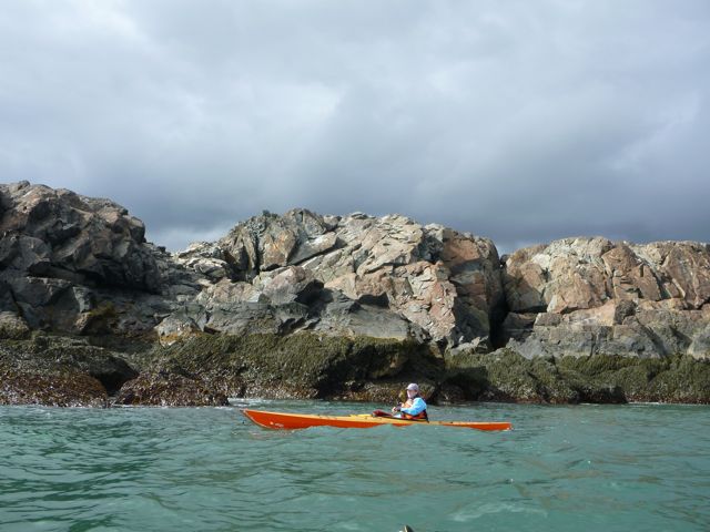
We followed the steep granite bluffs along shore and headed back out, following the shore out to Little Cape Point and across to Freeman Rock, a treeless hump of rock marking the edge between Mud Hole Channel and the open ocean. We left the calm water of Eastern Bay for calm water on the ocean, which means a few swells coming in, breaking over the southern end and rolling along the steep, plunging shoreline. Earlier in the summer, razorbills frequent Freeman Rock, but there were no birds there today.


-->
In the narrow channel between Mistake and Knight Islands the tide had slipped away, revealing a rockweed-covered sandbar. We left the boats and followed the boardwalk to the Moose Peak lighthouse, where we sat and ate lunch.


-->
The forecast had called for scattered showers. After lunch, the northwest sky darkened, and as we passed the cliffs of Man Island, the wind suddenly increased. By the time we rounded Black Head, breaking waves dotted the sea beyond. The north wind hissed, steepening waves as it pushed against the incoming current. We bent our heads and paddled slowly into it, getting a slow, close-up look at Head Harbor Island’s wild, rocky east shore before making our way back to the launch.


Wednesday, May 16, 2012

The Foggiest Place in Maine


 A couple of hours’ drive downeast from Stonington, the Great Wass Island archipelago is a bit far for day trips, but we managed to get there mid-morning on Monday- four of us, and headed west with the current.


We had all day to get around Beals and Great Wass Island- on average, a trip of 14 or 15 nautical miles- and we’d managed to get there for probably the best weather this week would have in store- a little rain, mild winds. Still, fog drifted through, alternately revealing and obscuring our surroundings. In a place known to be the foggiest spot on the Maine coast though, this came as no surprise. 


Barb had paddled here quite a bit. I’d passed through Moosabec Reach once on my way to Lubec, but otherwise, it was all new. What a treat; it’s a very different feeling from paddling a place you know well. Nate often had his card compass out, taking bearings on what islands we could see, and Rebecca, attentive to paddling straight lines on her ranges, kept reminding us that there was a bit more current here than we were accustomed to. This was good practice, since we’d all just had classes.

 
The first task came before we got there: planning. It seemed to be going well, since the current gave us a push down Moosabec Reach and down the west shore of Great Wass. We wanted to round the southern end at around low slack tide, before the wind and current turned against each other, so we ate our snacks on the water and admired the shoreline from a distance. 


But the real fun began as we rounded Pond Point and began following the rocky southern shore. With a 2 to 4-foot swell, it could get interesting.


I would imagine that playing among the rocks and waves is a bit hard for the uninitiated to understand. It might sound a bit like we’re just paddling around and running into rocks. Okay, maybe that’s part of it. As we head into a promising rock garden, we have little idea what will happen. We paddle around and watch the waves come in, see what happens, look for opportunities. Sometimes then, we run into rocks. Sometimes we ride waves over them, and occasionally we get about half-way over before the wave goes away. Nate is pretty good at this.


Often enough, I’m following Nate, saying “you’re gonna get stuck,” or “I think I’ll pass on this one.” His Delphin is getting a few new scratches in the plastic, but with it flat-bottomed stern, it seems to be a perfect boat to balance atop a seaweed-draped boulder and then slide-off with the next wave without getting pitched to the side. Getting stuck makes it all that much more satisfying and impressive when you get it just right.


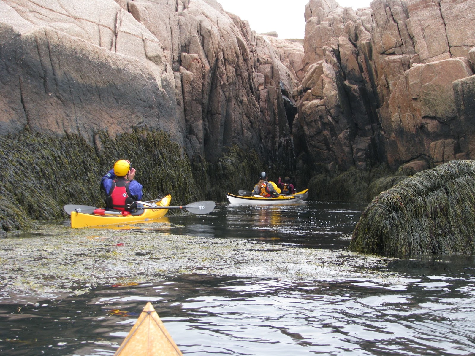
Some of my favorite moments came as we followed slots deep into the rocks. You might ride-in on a wave, and sometimes it’s tough to tell where it will lead. It gets a little quieter, the sound of surf muffled and distant. It’s a good feeling when you see water washing-in from the other side and follow it back out into the waves.


It’s a lot of fun. And best suited for daytrips where everyone understands that we might hit a section of shoreline that we’re going to take really slowly. It took us about an hour and a half to cover the southern end of Great Wass. And yet, that’s why we’re there.  And of course, it's good practice. Practice for what? Uh, doing more of this stuff.


And when you get out of the bigger conditions and find a few smaller waves, and some challenges that aren't likely to result in your getting pasted onto the rocks if you screw-up, well, it's really really fun.


And it makes lunch especially satisfying when you get to try-out the whale bone furnishings.


The day got away from us pretty quickly, but Moose Peak Light on Mistake Island beckoned, along with a few more opportunities for playtime in the rocks. There's been a light there since 1827, the present one since 1887. The best view... from a sea kayak, just offshore.


We all ventured into a narrow chasm near the lighthouse


And Nate took a swim.


If that wasn't enough, the paddle back to the launch took us past scores of seabirds and eagles watching us from granite-edged islands. Curious baby seals followed occasionally. It turned calm and the sun even peeked-out from the clouds.


All a bit overwhelming... and tiring. We returned home late, and the next morning, if the boats weren't still strapped to the car, it might have all been a foggy dream.