Showing posts with label Hiking. Show all posts

Sunday, October 6, 2019

Isle au Haut - Camping at Duck Harbor


As with our canoe trip the previous week, we were dragging our feet about getting out to Isle au Haut. I’d made the reservation for Duck Harbor Campground back in early April, which is pretty much the only way to get a reservation for the five-site, National Park campground. As the only public camping area on Isle au Haut, its sites are in high demand. The sites are deluxe – perhaps what some would call ‘glamping’ if you rigged-up a few string lights. Each site has a three-sided shelter, a picnic table and fire ring. There’s a couple of outhouses, and drinking water comes from a well just down the trail. It’s the perfect base camp if you’d like to spend a day or two exploring the rugged and remote southern end of Isle au Haut, either by paddling or on foot. 


If you’re just tuning-in, Isle au Haut is the big island (about 6 miles long and 2 miles wide) that lies 5 or 6 miles south of Stonington, our home on the Maine coast. Much of the island is part of Acadia National Park, but unlike the heavily-populated part of the park on Mount Desert Island, which is thick with tour busses and very casual visitors, access to Isle au Haut is by boat only, which has a way of weeding-out the riff-raff. It takes a little effort to get out there. 

Of course, as the big island on the horizon, it also has a way of attracting people who don’t know what they’re getting into. A decade or so ago, Outside magazine ran a short, rather misleading piece touting the island’s merits, suggesting that novice paddlers ought to rent a kayak and just head-out to the island, flagging-down a lobster boat along the way to grab dinner, and then “crash” in one of the lean-to shelters. For a while at Old Quarry, the ‘kook’ factor, already high, greatly increased. I still encounter paddlers whose plan is simply “Isle au Haut,” never mind the archipelago along the way, or the fact that much of the shoreline there is private or difficult to access. (Or the fact that paddling skills, including navigation might come-in handy). There’s a tiny village near the island’s north end, home to about 40 year-round residents and more in the summer.


As is often the case for us, getting out the door took more effort than it should have, and we didn’t launch until sometime in the afternoon. We had the current and a north wind helping us along, but if we’d continued to Duck Harbor we would have arrived around sunset. 


After 45 minutes of paddling, we paused below the campsite on Harbor Island, eyeing the sun sinking toward the Camden Hills, and decided to spend our first night there. We had the maximum 3-night reservation at Duck Harbor, but as much as we wanted to get there and wake the next morning to a full day, we prefer to avoid late-day arrivals, especially when the seas are lively, as they were even in Merchant Row. So we camped on Harbor the first night.


The northern campsite on Harbor is a favorite (although I suspect I might say the same of any island in the archipelago when I happen to be camping on it). The granite ledge slopes gradually down to the water, where a cushion of rockweed makes it easy to pull a kayak ashore. We pitched our tent on the soil just above the ledge. I quickly set-up the stove on a particularly flat-topped boulder to cook dinner, and Rebecca remarked that I seemed to have the routine worked-out. I’d camped there a few weeks earlier with a client and used the same rock, and had probably used it in the past as well. There were a few mosquitoes, but we carried our dinner to a windier, bug-free outcrop and watched the sunset. By bedtime (pretty early these days) the wind further shifted northward, and it rustled our tent fly all night.


By Monday morning, we’d lost our previous sense of hurry and took our time leaving Harbor Island and then meandering out through the Isle au Haut Thorofare, past Robinson Point Lighthouse, and then the last couple of miles to Duck Harbor. 


We parked our boats by the trail and carried our gear in Ikea bags up to Site #5. Only two other sites were occupied – perhaps thanks to the cool, windy weather and a rainy forecast. We’d stayed in the other sites, and this was our first time in this one, which is set-apart from the others, a little more remote, adjacent to a trail leading out to a cobble beach. We ate a late lunch and took a couple of walks, finally watching the sun begin to sink from the rounded granite hump of Ebens Head.


The first time we camped at Duck Harbor, years ago, we thought we’d use it as a kayaking basecamp. One could do that, especially if you wanted to don a helmet and get into the extensive rocks and ledges along the island’s southern end. But lately we had paddled enough that the simplicity of walking seemed a luxurious indulgence. Plus, you get to wear dry clothes. We headed-out around Western Head, pausing frequently to take pictures and just sit and take it in. 


It was nearing high tide when we arrived at Western Ear, the small island barred to Western Head at the southern end. Meaty waves rolled-in from the southeast, colliding over the bar with smaller ones from the west. We watched as the tide rose, mesmerized, regretting a little that we weren’t in our kayaks – I’d never seen such waves at this spot. Usually when I paddled around Isle au Haut I was out here around low tide. But this was a day to sit on shore and watch, which became more obvious as we walked the Cliff Trail. 


At every spot where the trail poked-out for a view of the waves crashing against the rocks below, we had to stop and take it in. 


We ate all our snacks. A walk that might take 2 or 3 hours grew into a 5 or 6-hour hike. We encountered no other hikers that day, and the only boats we saw were a couple of lobster boats.


The winds that day, Tuesday, were from the south, and would have made our paddle back to Stonington easier than in the strong north winds predicted for Wednesday. But by the time we arrived back in camp for a late lunch we were tired and didn’t feel like packing-up and paddling. Besides, reservations out at Duck Harbor are hard to come by, and you might as well make the most of them. 


We spent one more night and paddled back amid lively seas Wednesday morning, into a powerful headwind: exhausting paddling. It really was a mistake to not head back a day earlier, when the wind was in our favor, but it allowed us another long, leisurely day out there. And now with the hard work behind us, when we’re no longer cold and wet, it’s easy to only remember the more enjoyable parts.


Every time we go out to Western Head, we’re struck by what a different world it is from Deer Isle, and yet so close. Every time we go, we resolve to get out there more often. A few weeks ago we paddled out in the tandem in a little over two hours – maybe that’s one way we can do it. Or we just need to work less and play more.

Notes:
Read more about this route in my book, AMC’s Best Sea Kayaking in New England.

Reservations for Duck Harbor Campground may be made starting on April 1st. I suggest you wait a few days though, until we have our reservation.

Sunday, October 28, 2018

West Rattlesnake, Chocorua, The Sugarloaves


At the check-out line, the cashier, a woman probably a few years older than me scrutinized my face and asked me a question, and as usual, I needed to repeat it back to her to make sure I understood: “Am I… over fifty?”  

She smiled. She probably saw my hesitation, as if I still didn’t quite accept that I’d begun to slide into old age, that I might prefer to not admit it, and I didn’t exactly want to be reminded. Was I getting carded? I looked at our groceries and there wasn’t any alcohol, besides, she’d said fifty, and not whatever the drinking age was. Hutch and Shari were ahead of me in line; we were all together, our faces all still red and flushed from an afternoon hiking up a mountain after the first snow. She hadn’t asked them. They looked on curiously. She’d singled me-out; it was that obvious.  I shrugged. “Yes,” I said.

“You’re in luck.” She turned to the register. “You get a discount on Thursdays.”


We took our first walk on Wednesday afternoon, the day after Hutch and Shari had arrived. It was a pretty typical walk to take first-time guests on: West Rattlesnake, a small mountain that overlooks the lake. It’s a bargain hike: a relatively short and easy walk with the reward of a massive view at the top. Aside from being a good warm-up hike, we get a good look at the neighborhood from up above. The lake spreads below us, islands recognizable as if from a vividly colored map, with an autumnal red and yellow arboreal border. Rebecca and I like to take our friends up here and just stand for a bit and not say anything, not point anything out, just watch our visitors take it in and try to remember what that was like. But then we’ll point things out, just to get oriented: that lake over there to the left is Winnipesaukee. That mountain off in the distance to the west? That’s Moosilauke. We sat for awhile as others came and went, just taking it in until finally it occurred to us that maybe we should head back down.


On Thursday Hutch and Shari and I headed up Mount Chocorua, which quickly became ‘Chocula’ instead – it’s only a few letters off, and the name of the vampire-themed cereal is much easier to pronounce. The hike began in autumn, beneath a canopy of vivid green and yellow foliage, but progressed into freshly-fallen snow that became ankle-deep by the time we stopped at the Jim Liberty Cabin for lunch.


The cabin is there for overnight stays, first-come, first-served, with nine wooden bunks and decades of graffiti scored into its woodwork. Heavy chains secure it to the ledge, and there’s a hint of a view between the spruce trees encircling the small meadow around it. It all lay beneath a heavy, wet layer of snow, which still clung to the spruce boughs like sugar frosting on a gingerbread house. I remembered a visit from many years ago in which my friends and I spent a night there. Tents were pitched in the ‘yard’ and the cabin was crowded, dominated by the loudest occupants, drunk and boisterous, and it reminded me why I tend to avoid such places. But we had it to ourselves and we ate our sandwiches on the porch steps, admiring the fresh snow.


We progressed up the trail, and within minutes paused to turn around. We all gasped involuntarily when we saw the view. Whatever our expectations, they were surpassed. The nearby trees lay beneath heavy snow, while down below the white frosting tapered, blending with bright reds and yellows and greens, a study in contrasts. It had been snowing intermittently still, but sunbeams bore through the grey layer of clouds, lighting startling patches of color. 


This alone was worth whatever effort the hike had taken, which was good, since not much farther up the trail we decided to head down without reaching the summit. Had the snow been deeper, we might have been able to find traction along the path, but the unstable single layer of snow tended to simply slide away below us on the steeper parts – with consequential drops beneath them. Microspikes wouldn’t have been effective, but it hardly mattered; that revelatory glimpse buoyed us as we walked down, and later it carried us through the grocery aisles so that even the cashier’s reminder of my advanced age only further elevated the mood.


The next day, after a late morning, we were in the mood for another bargain hike in a different neighborhood, so we drove up to the north side of the White Mountains to a pair of smaller mountains called the Sugarloaves. Again, we began in autumn and gradually ascended to snow-covered ground, although not nearly as deep as the previous day’s. It was still chilly, below freezing, but the wind had died and the sun shone with hardly a cloud in the sky. 


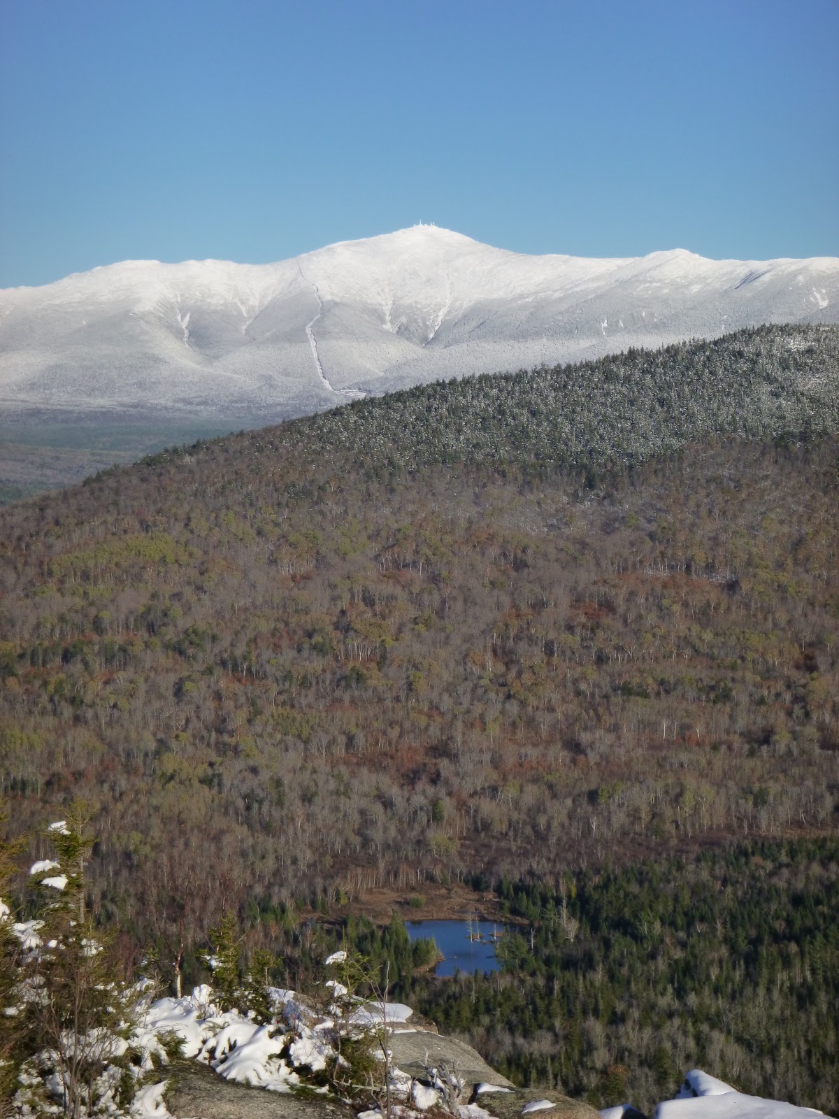
This is another true bargain hike, and the snow made it even more so, since the surrounding peaks, including the Mount Washington massif, were sparkly white, frosted like a heavily-sugared breakfast cereal. And you get not one, but two stunning mountaintop views, from both North and Middle Sugarloaves. We looked up at considerably higher peaks I’d been too fairly recently, like North Twin and Mount Hale, where the views are not nearly as overwhelming.


We returned to the trailhead not long before sunset and grabbed coffee at a gas station for the drive home, which took us through Franconia Notch at dusk, listening to nostalgic oldies on the radio – songs from the eighties and nineties that had been popular, it seemed, not so long ago, soundtracks to fleeting episodes from our pasts.

Notes:
We got to know Hutch and Shari over the summer when they worked with us at Old Quarry. They’ve spent most of the last six years living in a tiny ‘canned ham’ travel trailer, traveling all over and documenting their adventures on their blog, Freedom in a Can.


Info on these hikes can be found both in the AMC White Mountain Guide and in AMC’s Best Day Hikes in the White Mountains by Robert N. Buchsbaum.


Tuesday, October 16, 2018

Autumn Leaves on Mount Avalon


I’d been walking a short time, gazing down at my feet stepping through a golden-yellow layer of recently-dropped birch and aspen leaves, when it occurred to me that my pace was falling in step with the rhythm of a tune moving through my mind: Autumn Leaves. Aside from the obvious reference to my surroundings, the tune set a comfortable, relaxed pace, a good way to start a hike, and I didn’t mind. I seem especially prone to getting these ‘earworm’ tunes stuck in my head, following me for miles while I paddle or hike, and they’re not always so unobtrusive. Sometimes it’s the last tune on the radio en route to my adventure, but it may also be a recurring theme, like the instrumental disco anthem that followed me for much of the Maine coast on our Upwest & Downeast paddle last year. More and more it seems my earworm tunes lack lyrics, which I find agreeable enough, especially when this figment of my imagination drives the constant, multi-pitched ring of tinnitus, another made-up sound in my head, into submission.


I was headed up the Avalon Trail in Crawford Notch, which is a bit of a bargain hike to get to a view of the valley. But I was lured by the proximity of a couple of taller mountains, Mt Tom (4051’) and Mt Field (4340’) upon whose flanks Mt Avalon (3442’) is situated. Though I wasn’t expecting huge views from the taller summits, I was in the mood to walk, and it was a warm sunny day, probably the balmiest we’d see in October.


The tune cycled through my head, mostly drawing from the version I’d heard the most, from Cannonball Adderly and Miles Davis. I’d never known the song’s lyrics, but somehow the instrumental versions convey the bittersweet sense of longing and wistfulness at least as well as any words could. I don’t know how that works – that a simple tune seems to embody ideas and feelings without the help of spoken language, but it does. And since a melody is more universal than lyrics, it seems to apply itself to your surroundings more readily. The warm day made me more aware of its passing, wistful for all the summer days now past, and the leaves were probably as bright as they would be before the next storm knocked them down and the season rounded the corner toward winter.


I’d been in New Hampshire for about a week and I’d gone for a couple of other hikes as well. The first was not well-chosen for my first hike after a summer of paddling and little hiking. I headed up North Twin Mountain (4761’) with aims of getting over to South Twin (4902’) but I never quite got into it. It felt like a lot of work. My leg muscles burned with the uphill effort and I ended up with a headache (perhaps a bit dehydrated?) that took away from my enjoyment when I got to the summit of North Twin, which was socked-in by dense clouds. I finally remembered the ibuprofen in my first aid kit, which helped, but I had to admit I wasn’t really enjoying it, and headed down after a snack on North Twin.


For my next hike, I lowered my ambitions considerably, and had a gorgeous warm day. It was the Friday before Columbus Day weekend though, and the Kancamagus Highway was busy enough that I felt annoyed by the time I parked at the trailhead for Hedgehog Mountain (2532’). 


Despite the tailgating traffic that jammed all the scenic turn-offs, there were only six cars in the lot. I’d been to the trailhead before, and had one of those uncertain moments, unsure if I’d taken this hike before, but if I had, I’d forgotten it well enough, and it all seemed new and wonderful. You don’t have to go far before you step atop open ledges for expansive views of the 4000-foot mountains surrounding this little peak. I only ran into a few other people, but the trailhead lot was full when I returned, and I resolved to forego hiking until the weekend was over.


I did, however, drive to southern New Hampshire to buy a used canoe, and since I was in the neighborhood, thought I’d take a hike up Monadnock, a small mountain I’d climbed many times in my youth, when I lived in that area. As I approached the road into the state park though, I saw that it was closed off by the police – no room for more cars. They were doing me a favor, since such crowds would drive me nuts. Besides, I wanted to try the new canoe. In between hikes, I’d been out for a few short paddles, in kayak and canoe. They’ve been nice, but when I’m in New Hampshire I tend to think more about hiking.


The highlight of the Mt Avalon Hike was Mt Avalon, even if it doesn’t feel like much of a summit. There were also some enticing waterfalls, not far in from the trailhead. Mounts Tom and Field were fine, but you know you’re at the summits mostly due to the piles of rocks marking them, with limited views nearby. The top of Mt Avalon feels more like an open ledge on the side of Mt Field, but has by far the best vantage. A few other hikers came and went while I sat there, eating my sandwich, watching the cloud shadows pass over the brilliant patchwork colors in the notch. I could see our red car parked beside Route 302 down below, and not far away, the bright red roof of the Mount Washington Hotel. The summit of Mount Washington was shrouded in clouds, never revealing itself.


I overheard a couple counting the 4000-footer mountains they’d been up, and I suppose that personal challenge (much like the MITA 30-In-30 Challenge I’d embarked upon over the summer) brings a lot of hikers to these and other peaks that, while they offer some nice hiking, have underwhelming views for the effort involved. I joked with the couple that there was nothing wrong with the views; after all Mt Tom had a nice spruce tree with some lovely mosses surrounding its base, as cultivated as a terrarium. And of course there were those piles of rocks. Mt Field had a view of Mt Washington from a small opening in the trees.

When hiking to mountaintops I often remind myself that Thoreau wrote in his journal “… It is remarkable what haste the visitors make to get to the top of the mountain and then look away from it." It’s just a reminder that there’s more to a mountain than the view away from it, but it can also be a bit of a rationalization when you’ve just sweated to a mountaintop and there’s not a lot there that makes you want to linger. But Mt Avalon’s views were good enough to make me linger, and for just a little while forget the tune in my head.


Notes:
In addition to AMC’s White Mountain Guide, I’ve been using AMC’s Best Day Hikes in the White Mountains by Robert N. Buchsbaum. The book helps winnow the nearly endless hiking options in the White Mountains down to a few of the more attractive ones. In addition to the nuts and bolts info in the White Mountain Guide, there’s a bit of the author’s take on what it’s like to hike in these spots, why one would want to go up one trail instead of another, as well as historic background and natural history.


Monday, May 28, 2018

Time-Out on Western Head


Sometimes, during the first five minutes of a paddle it feels like hard work, and I wonder: how am I going to go x miles today? And then, hopefully, we become a little less aware of the effort, focusing on executing a clean and efficient forward stroke, making a few turns around the rocks along shore, and maybe we start chatting. The miles go past, we get where we’re going, a little more worn-out than maybe we’d like, but we’re paddling again.


It was like that the other day when Rebecca and I left Old Quarry for a two-night trip out to Duck Harbor on Isle au Haut. And we weren’t surprised to feel the paddling muscles grind so slowly into action; we’d just gone through a winter of no paddling – the longest paddle-less stretch we’d endured since we dove into the sport. In Newfoundland, we got in a few excursions into November before the wind and snow and cold made such trips less enticing.


But it felt good to be paddling in the Stonington archipelago again. We’d been here at Old Quarry Ocean Adventures for seven weeks, and we’d kept busy, helping to get the place ready for another summer. It’s amazing how much pre-season work there is to do here: downed trees, tired kayaks, a new reservation system in the office, boats to launch – projects everywhere you look. Old Quarry is even opening a new shop in town. And in early May the kayaking work began to trickle-in again, both here and with Pinniped. So I had paddled some, but only for work. The work/play paradigm quickly reminded me of what a gift last summer was: two months of living out of our kayaks along the Maine coast, just going where we wanted to go, at our own pace. 


A few days before Memorial Day weekend when the season really began, we had coveted reservations at Duck Harbor, Acadia National Park’s remotest and smallest camping area, with only five Adirondack-style shelters near Isle au Haut’s southern end. The day felt perfect: sunny, almost warm, and we took our time, stopping to take-in Harbor Island and then Nathan Island before paddling through the Isle au Haut Thorofare past the village, where hardly a soul stirred. Passing Robinson Point Lighthouse and then Trial Point, we were drawn onward by the gently-building swell and the broad horizon ahead. The southwest shore reached seaward, a craggy stretch, interspersed with cobble beaches. By then, the western sky had darkened with tall cumulonimbus clouds, and it seemed prudent to get where we were going.


It was a good choice. Thunder rumbled as we pulled our boats ashore and carried our gear in Ikea bags up to our site. We’d no sooner stashed everything inside the 3-sided Adirondack shelter when the storm hit. I hung my hammock across the entrance and watched the rain pouring from the roof only feet away. Nice.


We spent most of our time there hiking: slow dreamy hikes out to Ebens Head and around Western Head. We paused on cobble beaches for hours at a time to read, take pictures, have lunch or just nap in the sun. It was pretty quiet: few other people.

  
While all of Isle au Haut is relatively remote and wild, the southern end, which is mostly part of Acadia National Park is especially off in its own world.


On Friday morning we woke to the white background roar of the sea: strong southwest winds and swell, the surface of West Penobscot Bay a messy froth of breaking waves. It was a challenging start, and a bit intimidating since we were out of practice, but we fell into the familiar rhythm, occasionally pausing as we heard a beam wave rise beside us and crumbling beneath our hulls, sometimes opening a plunging trough before us. Frequent splashes over the bow or the cockpit reminded us of how cold the water was – the buoys all still reporting high forties – and increased our resolve to remain above the surface. We got through it, and past Trial Point we were able to turn north and let the seas push us toward the lighthouse where the waves diminished.


We took a break on Steves and made it back to Old Quarry in time for my afternoon trip.

Notes
Duck Harbor Campground requires reservations well in advance and is mostly filled in early April after reservations open. However, the campground has a new online system that is easier than the old mail-in process. It also makes it possible that cancellations could result in last-minute openings, so it’s worth checking, even in mid-summer.


This route is covered in Trip #15 in my guidebook, AMC’s Best Sea Kayaking in New England. If you haven’t already, you really ought to buy this book.

If a guided experience in this area interests you, I will be guiding a multi-day trip in the archipelago/Isle au Haut area, in early August through Pinniped Kayak.
-->

Tuesday, December 12, 2017

Green Gardens Hike, Newfoundland

-->

The northeast corner of Bonne Bay rises up to a rugged, barren ridge called The Lookout Hills, the biggest of which – Big Lookout – is 600 meters (1968 feet) above sea level. And it’s only about a mile from the sea, so it’s a pretty steep slope that more or less drops right into the ocean. From where we’re living right now, we look out across Bonne Bay at this ridge, as well as the mouth of the bay. It is spectacular. We've been here about two months now, and it is still difficult to look out the window without getting momentarily distracted – a good problem to have.


It’s good to have such a view when you’re inside working much of the time, which is how we spend the first parts of our days. Distracting as it may be, it makes you feel like you’re not totally missing-out on what’s outside. Sometime in the afternoon we usually get out for a walk on one of the shorter trails, not so far away, as much to stretch our legs and get a little exercise as to explore and take a few snapshots. There have been a few days when we realize, usually too late, that it would have been okay for a paddle, perhaps in one of the more sheltered nooks of the bay, but we’ve felt more motivated to walk than paddle. Most days the temperatures have hovered in the low 30s (or around zero, as they say around here) and it tends to get windy at some point. 


I’ve often gazed across the bay at the Lookout Hills and wondered what it would be like over there. Just beyond that ridge, around the corner from this view we have, the shore stretches about 8 statute miles to the southwest, to the town of Trout River. It’s a rugged stretch of coast, but there’s one area with a popular trail, called Green Gardens, so named for the gentle, rolling pastures perched atop the steep, shore-side cliffs. It is all part of Gros Morne National Park.


A week ago we took a hike down to Green Gardens. This is a full-day trip for us, since the trailhead is about an hour’s drive from here, and the hike itself- the short version that just goes from the trailhead down to the sea, and then back up – is about 9 or 10 kilometers (6 or 7 miles total). (The longer version is now closed, due to erosion). The weather forecast didn’t look great- a bit windy in the morning, increasing to a gale warning in the afternoon, along with the arrival of a snowstorm. But it was the day we had planned, the day we could do it, so we stuck to our plan – which, I was too aware, is the auspicious beginning of many outdoor survival stories. 


The trailhead lies high on a plain between The Tablelands and The Lookout Hills, in a treeless, rocky tundra, gorgeously austere, but with nothing to buffer the wind. We had it at our backs for the first stretch, a mile or so in which we climbed a couple hundred feet in elevation, and were aware that returning against it might be difficult. We reasoned that after we crested the hilltop, we would be somewhat sheltered as we descended toward the ocean- and we were. It’s a different landscape on that side, with trees, ponds and meadows. The Gulf of Saint Lawrence came into view, steely grey, corrugated with whitecaps, and we made our way down toward it, stepping through shallow snow, which tapered-out into mud and bare rock as we descended.


It’s a bit backward from hiking up mountains. We hiked mostly downhill to our destination, and had an uphill climb to look forward to for the trip back. But the destination – Green Gardens – was astonishingly beautiful, even now, when it wasn’t all that green. We came to the tops of steep cliffs and walked along these meadows and pastures, dotted with piles of sheep poop, looking down at rocks and sea stacks below. It invited us to imagine paddling there. We were glad to not be paddling then- cold and windy as it was, but what a playground! The near-shore area lay in the lee, the whitecaps and big, lumpy seas beginning maybe a quarter-mile out. The shore had big, dark beaches and cliffs – probably anywhere from fifty to a hundred feet – rising just above them. 


And the pastures themselves felt like playgrounds, grassy fields to romp through, with weird rock formations like sculptures or perhaps the set of a Dr. Seuss drama. On top of that, there are some campsites there: tent platforms, picnic tables, privies. I wouldn’t want to carry boats and gear up there from the shore (and you would probably need to carry everything up, unless you were sure the tide wouldn’t come too high) but it would be a great place walk to and camp. 


We walked a little ways down the shore, had some lunch and then headed back-up. We knew the storm was coming, and as if on cue, the snow began.


We encountered a young woman walking toward us, which came as a surprise, with the storm coming, and she didn’t look terribly prepared. But she also looked young and energetic. The wind increased as we climbed – we had nearly 800 feet in elevation to attain – and as we came back over the ridge, it hit us in the face, driving the snow – and sometimes painful bits of sleet – into our faces. But we were warmed-up from the climb, and just leaned into it, savoring the severity of the scene. It was a relief to climb back into the car. 


We worried about the young woman we’d encountered, and stopped at the park office to let them know she was out there. A ranger said he’d keep an eye out and make sure she got back to her car.


Notes:
This hike is in Gros Morne National Park. Visitor’s centers are closed for the winter, but you can find information on their website. They sell a small-scale topo map that covers the whole park – not a lot of detail, but it gives you an idea where you’re going.

I also have enjoyed Hikes of Western Newfoundland, by Katie Broadhurst and Alexandra Fortin. It provides basic details for a number of hikes in the area, including several off-trail, multi-day backcountry hikes, which certainly fuels my imagination for warmer-weather treks. Alex Fortin and her partner Cory also have a website called Wildly Intrepid, which is full of inspiration for adventure travel.

I’m really pleased that a photo I took was chosen as the winner of The Preserve Prize in Maine Coast Heritage Trust’s Wild Maine CoastContest. The photo was taken at Western Head Preserve in Cutler, and is described in this blog post from September. There were a lot of gorgeous photos entered in the contest; I’m very grateful to have been chosen.

We still don’t have much in the way of plans; we’re mostly focusing on the present, trying to get as much work done as we can. Hopefully we’ll share some of that before too long. Of course, lately our distractions have included not just the magnificent view from the window, but from where I sit at the kitchen table we see the occasional spouts and diving tail flukes of humpback whales, as well as others. There's herring in the bay, and at night, the lights of seining boats float out there in the dark.

We’ve also been able to spend some time with Rebecca’s parents, and with other family and friends. I’ve continued to post snapshots every now and then on Instagram. I’m still not sure why I’m doing this (a bit like writing blog posts) but it is oddly compelling, and I enjoy perusing other people’s photos more than a lot of the ‘content’ that gets passed-around on Facebook. 

Oh yes, I suppose it's worth mentioning: my sea kayaking guidebook, AMC's Best Sea Kayaking in New England makes a great gift.