Tuesday, September 25, 2012

Afternoon on Wreck Island


I had big ambitions for a four-day trip this week, but bit by bit, those plans changed. At first I planned on a paddle through the Muscle Ridge area, but car troubles put the kibosh on that (unless I wanted to spend a day paddling there and a day paddling back). I was happy enough to alter my route to a trip around Vinalhaven: over to Seal Bay and through the Thorofare to explore the west side for a few days.


But when mid-week winds appeared in the forecast, I figured I'd instead spend Monday paddling out to Brimstone and around the exposed southern end of Vinalhaven- save the windy days for the more sheltered areas. On Monday morning, the forecast looked even windier and rainier. I imagined my paddling vacation turning into a hanging-out in the tent on an island reading vacation- and possibly waiting for good enough weather to get back across East Penobscot Bay. I'm fortunate to be able to change my plans. I don't mind hanging-out on an island reading, but if instead I stayed home and got some work done, maybe I could take my paddling vacation when the weather improved. It was a tough choice to make- my gear was all packed- but I made it quickly.


But Monday still looked good: not much wind, mostly sunny, and according to the sign on the gallery, we're supposed to be closed. I asked Rebecca if she would like to paddle around Isle au Haut- after all, the tides were right. We started getting our gear together, but first, we had some gallery business that had come-up, since after all, we were there. It took awhile. By the time we launched, we felt lucky just to get on the water at all; Isle au Haut was no longer an option. As we paddled, we kept glancing over at the immense dark clouds in the west, trying not to acknowledge that yes, that was headed our way. We decided to stop at the beach on Wreck Island. At the very least, we'd get a little sunny beach time before the weather caught-up with us.


It may sound like one disappointment after another, but we were happy to be there at the beach on Wreck Island. We ate our lunch. Rebecca swam. We drank our chilled bottled beverages while the sun shone, and when the clouds moved in I made coffee. Rebecca painted, I read a paperback. We watched the tide rise and the schooners motor into nearby anchorages.


Sometime after five we relaunched and paddled over to check-out Heritage as her passengers returned from their cook-out on shore. Then we paddled around McGlathery- just enough swell to have a little fun.

And while we're at it, maybe we could check-out the unique hull shape of the Sirius:


The nice thing about clouds; they make for more interesting sunsets.


I'd like to say that I make my choices and don't look back, but I've been compulsively checking the wind data from the weather buoys. I think I would have found some relatively sheltered areas to paddle, but maybe what we really needed was a relaxing afternoon on Wreck, and a gorgeous sunset paddle back home to Stonington.


Tuesday, September 18, 2012

Seal Bay, Vinalhaven


Seal Bay on Vinalhaven is one of those areas of the chart that my eye is drawn to, and once there,  lingers for awhile as I realize how much shoreline is packed into those inlets and how little of it I've seen. I've paddled through it a couple of times, but it seemed time for another visit, and with a mid-day high tide, I might be able to explore a cove or two.


Of course, getting there is half the story. Six or eight miles from downtown Stonington, Seal Bay is on the other side of East Penobscot Bay. If it were a little closer, this might have been a day trip. I headed west out of the Thorofare and pointed somewhere between Mark and Scraggy Islands at a slightly higher patch of shoreline a few miles away. The appeal of such crossings lies more in the imagination - the possibility of getting places- than it does in reality. You try to paddle a straight line, and just keep going. I thought about this and that, and tried to avoid looking at my watch. The wind and waves were bigger than I'd anticipated and, paddling a fairly unfamiliar boat, I had a few moments of doubt. But those moments passed. Less than two hours after leaving Stonington, I arrived at a point of land on Vinalhaven, and slipped through the gap between Coombs Neck and Neck Island.


Right away I passed a few simple cabins, right on the water. They got my imagination working- it seems that you don't see too many waterfront cabins that haven't either been fixed-up or torn-down and replaced by zillion-dollar architectural marvels on their footprints. These look like they've been unchanged for awhile, except for that one on the right, which still looks like a boathouse, but with a nice place to hang-out on the deck. Perfect.


I followed the twists and turns of the easternmost cove and finally took a break on a ledge. The shoreline is probably all privately-owned, but it's mostly undeveloped and wild. Smith Cove was much the same, just bigger- only a few houses on it.


I could see Hay Island, where I planned on stopping for the night, but I wanted to check-out as much of the bay as I could while the tide permitted. "Bay" seems a deceptive term for the body of water. It's mostly very shallow, and as the afternoon went on, more and more ledge and mudflats were uncovered. At Burnt Island, I carried across the rocks barring the island to Vinalhaven. 


I followed the shore to the west end, but with the water quickly draining, I didn't want to get stuck, and headed back out along the shore of Penobscot Island. The area between Burnt and Hay islands is a popular anchorage- a hurricane hole sheltered from bigger winds on the outside. A few sailboats were anchored there as I found my campsite, and a couple more arrived as I explored the island and ate my dinner.


The night turned very dark and I sat out on the ledges for a while, until a shooting star flashed across the sky. I figured that must have been what I was waiting for, and turned-in. The forecast on the weather radio called for increased winds the next day, building to gale-force as a storm arrived. I resolved to get up and get going early, which is what I did. 


I opened the gallery a few minutes late.

Wednesday, September 12, 2012

Paddling Home


There I was... boat all packed and ready to go on the beach in Bar Harbor. The students I’d guided all week were busy shuttling gear away from the beach, arranging big piles of drybags. I said quick goodbyes and slipped away, heading south. We'd come eight miles from Thomas Island on the north side of Mount Desert Island. Now I paddled toward a private MITA island just off of Great Cranberry, about twelve miles around the southeast side of Mount Desert Island.


Gliding past the Bar Harbor waterfront, I felt cut-loose, a little strange to be paddling alone; I could paddle any speed I wanted and not look back. Just past the breakwater at Bald Porcupine, I pulled into Compass Harbor and took a break on Dorr Point. Site of the former home of "Father of Acadia" George Dorr, the point is now part of the National Park and is a good spot for a breather before the next stretch, in which easy landings are scarce.


The coastline from Compass Cove to the southern end of MDI is a playground of rocks and ledges stretching five miles past sheer cliffs, undercut sea caves and towering rocky slots. Alone in my loaded boat with miles to go, I paddled conservatively, occasionally nosing into a slot or a cobble-beached cave... the sort of paddling that elicits constant wonderment, but also the sense that I haven't spent nearly enough time here and would need to return for more. I passed only two kayaks- a tandem and a single paddled by shirtless guys and a woman in a bathing suit- no life jackets- who appeared well out of their element in the minor swell. Just north of Schooner Head the private homes give way to the wild shoreline of Acadia National Park, and the people on shore begin; walking the trails, hanging-out on rocks (some literally hanging from ropes). After Schooner Head, Labor Day weekend visitors dotted Sand Beach and the stretch of granite shoreline from there to Otter Point. Happy to be alone, I stayed just far enough from shore to inhibit attempts at conversation.


Just west of Otter Cove, I pulled into a slot and landed on a cobble beach for a quick break before heading across to Little Cranberry Island. At the edge of the harbor I waited as several boats arrived, some driven by captains in blue blazers and khakis- arriving for the Islesford Dock restaurant's last night of the season. A little more paddling brought me to my campsite for the night.


A couple of other tents were set-up in the grass, but their occupants were absent. I carried my boat up past the tide line and set-up on a rocky ledge, eating my dinner as the sun went down and the full moon came up. A pair of kayaks appeared in silhouette, arriving from Little Cranberry. I met the paddlers later and we talked for awhile as it grew dark and the moon rose. They had come here on a whim, one from Portland, the other from Bath. They'd eaten dinner at the Islesford Dock restaurant, and planned on a leisurely Sunday. Again, headlights of cars snaked up the dark profile of Cadillac Mountain. With the fly off my tent, I slept in the moonlight, the barking of distant seals mingling with my dreams. Still in my sleeping bag, I watched the sun rise.


I had about twenty miles of paddling between me and Stonington, but I lingered over breakfast, enjoying the view of clouds easing through the hills on MDI. The sunshine lasted for a couple of hours, fading as I passed Great Gott Island and the Bass Harbor Head lighthouse. By the time I took a break on Placentia, a breeze picked-up, accompanied by intermittent rain.


Just before mid-day, I left the northwest corner of Placentia and pointed toward North Point on Swans Island. Despite the tide being nearly high and slack, the incoming current swirled back on itself as it squeezed into the mile-wide gap between the two islands, making distinct eddy lines. I hadn't noticed the "tide rips" indicated on the chart north of Staple Ledge before, but it looks like another place to investigate sometime at mid-tide and see what's happening out there. I passed the mouth of Mackerel Cove, and through York Narrows, stopping at a couple of small islands, just to check them out and have a sip of coffee before crossing Jericho Bay.


I wanted to get across Jericho Bay before the mid-tide current picked-up too much, so I pointed toward Scraggy Island and Eastern Mark Island behind it, and started across. 


After all the guiding and teaching I'd been doing over the summer, this respite of solo paddling felt good. Over the last week, I'd heard fairly constant banter as I paddled- rarely a quiet moment, my rhythm determined by those around me, paddling in fits and starts, my blade often moving through the water with minimal effort so that I would not pull ahead. It seems that if you paddle this way enough, your own groove will fade into the past, perhaps permanently. As I paddled home, I found songs popping into my head once again, and I went long stretches without pause. Weather and waves came and went without comment or discussion.


Passing Eastern Mark Island, I re-entered my home archipelago. The rain tapered away and the dark clouds passed behind me. The sun came out, and even though I looked forward to getting home, to a long soak in a tub of hot water, I wanted to savor the trip just a little longer. I pulled off at Clam Island- a ledge north of Millet. Beyond Isle au Haut the sky remained stormy and dark. I ate the last of my trail mix and finished-off the peanut butter and jelly; it would taste better now- as I sat on a rock that had been submerged a short time before- than it ever would at home.


Saturday, September 8, 2012

Freshmen


Before each academic year, College of the Atlantic offers an orientation trip to their incoming freshmen. These trips range from hiking on the AT, canoeing on the Allagash, sailing and - of course, sea kayaking. Mel  (former co-proprietor of Bar Harbor’s Carpe Diem Sea Kayaking) and I would each take a group - seven students and two student leaders in three tandems and three singles- from Stonington to Mount Desert Island. Her group favored a more sheltered northern route around MDI. The student leaders in my group, veterans of Patagonian sea kayaking with NOLS and teaching sea kayaking to kids at Rippleffect, hoped to lead our group around the wilder and more exposed southern end of MDI. Of course, everything would depend on the weather and the group.


We met Monday morning at Old Quarry and spent the afternoon practicing rescues in the pond. In between learning to pack gear, setting-up tents and making meals, the groups circled-up often, getting to know each other. That was the real point of the trip. The fireworks that erupted that night over Stonington Harbor (they followed the Flash! In The Pans performance at the Fish Pier) seemed appropriate somehow. This was a significant time for these students. For some, that night was the first they had ever been camping.


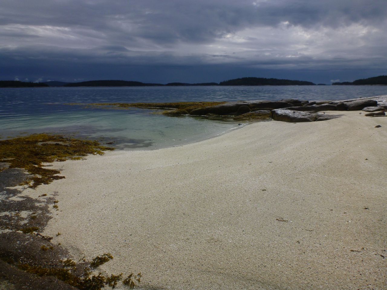
On Tuesday morning as waves of rain and fog swept through, we packed boats and launched.  The sky gradually cleared, but as we stopped for lunch on Saddleback Island, we had our eyes on tall ominous clouds growing in the western sky. Since the next day’s forecast called for strong winds, we’d decided to get across Jericho Bay while the getting was good. It wasn’t good for long; just as we started pulling our boats into the water, thunder rumbled in the west. We all looked at each other and I said “We’re staying here.” It pays to make lunch stops on potential camping islands.


We got camp set-up and the storm came through - not too bad, but had we left it would have caught us out in the middle of Jericho Bay. Everyone seemed content to be on Saddleback, especially as the sun came-out. Some of us hiked around the island. Later, we sat on the sloping granite slabs and ate dinner as the sun set and lights came on in Stonington.


We made our way to Bar Harbor over the next four days. We faced plenty of wind and waves as well as seasickness and other ailments, but the students’ spirits remained high, and they were patient - good at helping each other over the tough spots. They didn’t seem to care much where the route took us; it was all good. We camped at Hog Island, off Naskeag Point and on to Hardwood Island, where the owners gave us permission to camp above the beach. With forecasts looming for ever-increasing wind, our route shifted to the north side of MDI, and we made our way up through Bartlett Narrows and beneath the bridge to our last evening’s destination, Thomas Island.


We often played games as we paddled: “if you were a pirate ship, what weapon would you choose?” After everyone else had chosen deck-mounted machine guns or light sabers or whatever, I said I was a pacifist, just because my mind was on other things. We were, after all, in the middle of crossing Blue Hill Bay, with the tide picking-up against the wind, the waves growing steeper, and I really just wanted to get the group across. Of course, part of their goal was to distract their seasick friend.


One thing I like about teaching and guiding is seeing improvement- a change in people’s skills and confidence. This comes in many forms. The students who could barely make progress against the wind on Tuesday focused on their form, and by the end of the week had better forward strokes. On that last evening I vowed to myself to not nag about moving the boats above the high tide line. I wasn’t going to let the boats drift away on one of the highest tides of the month, but it was time for someone else to take charge, and sure enough, they did, pulling the boats up and tying them off to a tree. Some students took extra trips with me in the late afternoons, and it seemed clear that they’d discovered something that they might stick with.


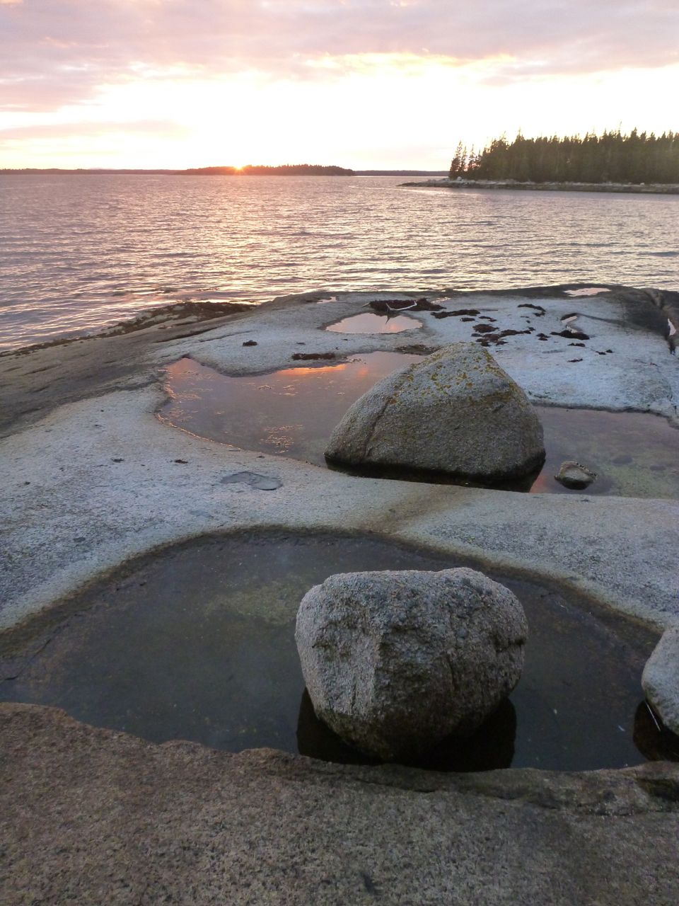
On the last evening, the full moon shone on Cadillac Mountain, where headlights occasionally poked through the night. We finished dinner and sat around a candle. That pirate ship question came back again, and I was encouraged to choose a weapon. I thought about the sci-fi television I’d seen lately and the answer just came-out: “an FTL drive.” After a moment’s silence, someone said “a faster than light drive... not bad.” I felt I’d passed a test. 


On the last morning, I suggested to the student leaders that they could take charge on the water and I’d hang-back a bit. The directions were straightforward enough: keep Mount Desert Island on your right for about eight miles until you see Bar Harbor.


We paddled straight lines far from shore- the most direct route to get us there. At Hadley Point we ran into the other group- they were heading-out for a day in the Porcupines. I suggested to my group that if anyone wanted to, we could check-out the Porcupines as well, but they seemed focused on the destination: the comforts of their new dorm rooms- flush toilets, television and computers. For miles, we paddled along while the students played games. Gandalf or that wizard from Harry Potter? Beatles or Rolling Stones (I woke up for that one- the sole Stones supporter). On and on. Nautical miles had been replaced by highway miles, and the games made them go past. I pulled into the caves at the Ovens- spectacular cliffs dropping directly into the sea- and the group kept paddling, getting far ahead without once glancing back to see if they still had a guide.


But it felt good to round the corner into Frenchman Bay and to see the Porcupines spread-out to the south. The predicted strong winds peaked before we launched, and the rest of the day looked relatively mellow. We passed Hulls Cove and a few big old houses on our way into Bar Harbor- passed the old ferry dock, and there it was: College of the Atlantic with its steel pier and a little beach just waiting for us. One by one we landed, and began unpacking boats. 

I thought I would accept a ride back to Stonington, but my boat sat near the water’s edge, ready, too much to resist. At mid-day, I still had hours to get to a campsite that night, and I could take all of Sunday to get back home to Stonington. I got rid of my garbage, topped-off my water, accepted a gift of some leftover chocolate (very much appreciated) and said my goodbyes. Then I paddled back to Stonington. Another story.