Showing posts with label camping. Show all posts

Friday, September 27, 2019

Lobster Lake - West Branch Penobscot Canoe Trip


Because we were cooking chili on the last night, there were the inevitable fart jokes and comments – the lure of sleeping without flies over our tents to allow better air circulation, the hope that the beans would run their course by the next day when we would all pile into the truck at the take-out. One might expect that laughing at flatulence would be the sort of thing we outgrow, but we – all six of us – ranged in age from late forties to early sixties, and we had not outgrown fart jokes. 


But then again, it was day three, and we’d been having fun, like kids, laughing easily at just about anything. We were at the Pine Stream campsite, on the West Branch of the Penobscot River in Maine’s North Woods, our canoes pulled-up on shore below us. 
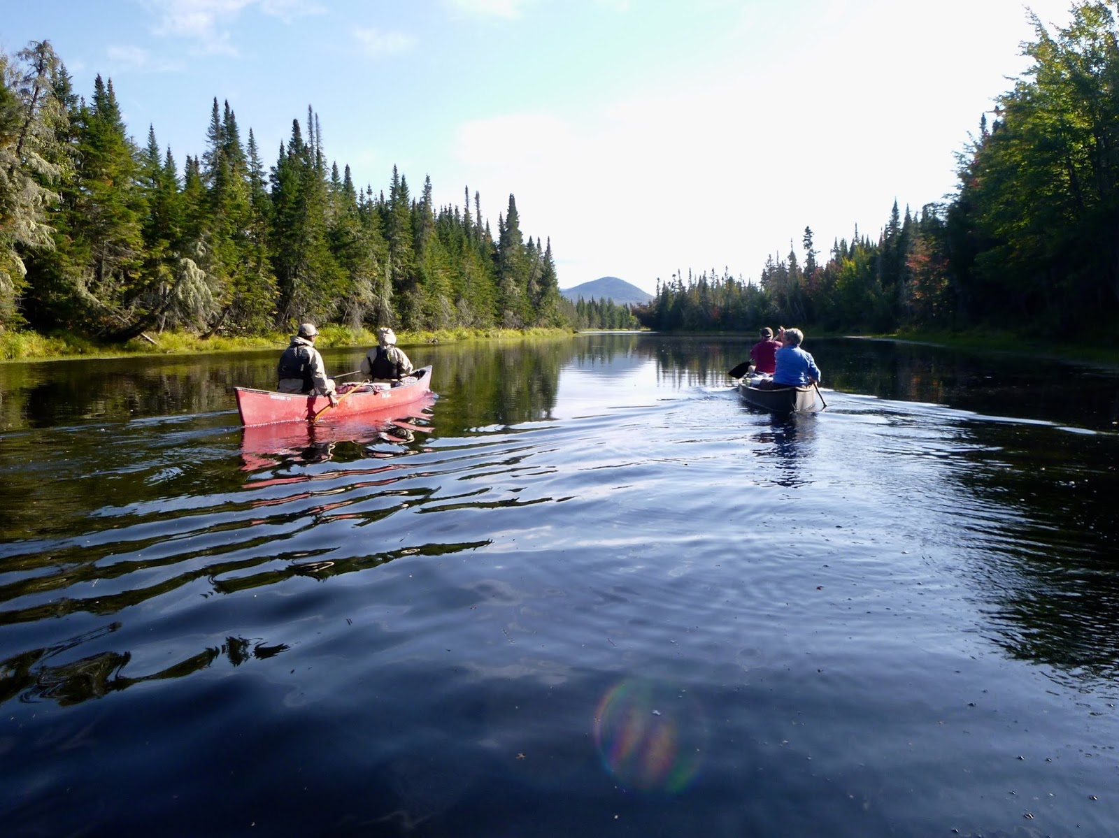

The trip had begun some 14 or 15 miles upstream where, instead of just paddling down the river, we’d spent our first night going up Lobster Stream to Lobster Lake. That first day we’d launched later than hoped. Rebecca and I had started the morning in Stonington where we’d been cat-sitting for a couple of weeks – a bit of luxury to have a bathroom and kitchen and a comfy couch with internet – a nice break from our trailer out in the woods. We left in the dark, as fishermen were arriving in town. We’d been up late, cleaning the apartment in anticipation of the owners’ return, our cars each stuffed with miscellaneous belongings and bins of kayak gear, and we were feeling weary of the unrooted nature of our lifestyle. We drove our separate cars over to Deer Isle, where the day before we’d loaded the canoes onto the trailer at our friends’ house. We finished loading gear and food, hoping we’d got everything, and set-off, six of us in the crew cab of Linda’s truck. We were hoping to meet our shuttle at 9 am, well over three hours away. 

Those plans dissolved quickly when, north of Blue Hill, a wheel came off the trailer. Linda saw it happen and stopped quickly enough to avoid destroying the hub, and amazingly, we found the wheel and tire intact, along with 4 out of the 5 lug nuts, in the roadside weeds. A man waiting with a child for a bus helped us get it put back together. At the time it felt like maybe the trip was doomed, like it was a sign. We’d all struggled with the decision of whether we would go or not. It seemed there was so much else going-on, and it would have just been easier to stay home. But we all told ourselves that these were mental obstacles, that once we got our butts into the canoes, we would be very glad we came. Now we weren’t so sure. At nine am, instead of meeting our shuttle, we sat in the waiting room at a tire store in Brewer, flipping through magazines. The truck and trailer could be shuttled later though, and now we were not beholden to a schedule.
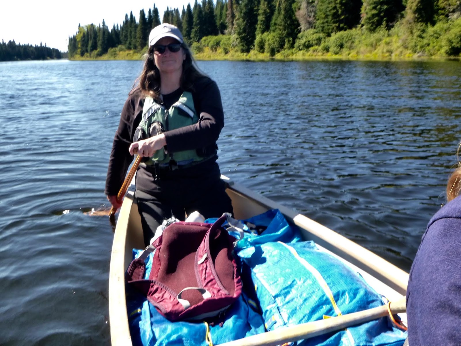


By then it seemed prudent to persevere; what else could go wrong? We launched mid-afternoon and paddled a few miles to our campsite at Lobster Lake. Along the way we had glimpses of Katahdin and other nearby mountains, but I was struck that the area was mostly flat, mostly wet, criss-crossed by waterways. Our canoes were piled with gear in the middle, some with coolers and folding chairs. In the back of my mind, I observed how this differed from doing the same thing in a sea kayak, but also compared it to a composite L.L. Bean catalog cover, and wondered if maybe I should be wearing plaid, or a more backwoodsy sort of hat. We camped at Shallow Bay campsite, above a sandy beach. Not far away, an L.L. Bean guided trip had camped on another beach, and as it grew dark, the glow of their campfire was the only other light we could see. 


On Saturday morning we paddled back up Lobster Stream, past the put-in, overflowing with trucks, and entered the West Branch of the Penobscot, where we suddenly had a little current helping us downstream. I started off paddling in the bow and it felt good to work on my canoe stroke, to get into a torso-turning rhythm, to know when to throw-in a little draw stroke to pull us around an obstacle. Our friends, unknown to each other before the trip, chatted behind us. I wondered when we might see a moose. We stopped to check-out campsites, but never felt like we’d gone quite far enough. Then when it did feel we’d gone far enough the campsites were full: big tents, fishermen, canoes with outboard motors. Around Big Island, the sites were all close enough to each other that you’d never feel quite alone. We stopped at a vacant site, ate a late lunch, and kept going until late in the day, when we were almost to the next lake, not far from where we would take-out. By then, the vacant site near Pine Stream felt a bit miraculous: a big hump of smooth rock rising from the river. Before the canoes were even unloaded we jumped off the rock, into the river, and swam. Fresh water: that’s another difference between sea kayaking and canoeing. 


While we ate dinner we easily decided to spend another night at this site. We liked the smooth rock and the broad view of a bend in the river with shallow, marshy banks. It seemed inevitable we would see moose here. At the first campsite there’d been tracks in the morning – a moose strolling right up to the tents – but we’d seen none along the river. There were plentiful tracks in the mud here as well. We decided we’d spend Sunday enjoying this place and taking a side trip up Pine Stream.  


On the map, Pine Stream winds several miles south, originating in several remote ponds. The water was only high enough to paddle a mile or two upstream though, so we got out and walked a little and then headed back, stopping for lunch along the way. We had a little down-time that afternoon, something we all needed. I lay in my hammock and read for a while.


The weather changed overnight, clouds moving-in from the west, the wind increasing, and in the morning we paddled the last couple of miles out the river to Chesuncook Lake with the wind behind us. Katahdin rose above the lake in the distance. We took-out at Graveyard Point and found the truck and trailer parked there. The rain began while we loaded-up.


Notes:
Moose seen: 0 (maybe they were anticipating the start of hunting season on Monday).

Shuttle provided by Allagash Gateway Campground, $225. 

There were a few other fees as well, a day-use fee and a nightly camping fee – all well worth it, but another notable difference between camping here and along the islands of the Maine coast, where it is generally free. So, groceries and gas aside, three nights of camping with a shuttle came to a couple-hundred dollars per couple.

Among our friends on this trip were Shari and Hutch, whose adventures living in a tiny trailer can be read about at their Freedom In A Can website. 

Friday, August 10, 2018

Escape From Old Quarry: Wheat Island

  
A few days ago, I had the sudden gift of a day off – just like I did last week: an entire day with no work or commitments. I could do whatever I wanted with it. So I got my gear together. I could do something epic. Maybe paddle around Isle au Haut. At first I thought I didn’t have to work until later on the next day, so I packed camping gear. Then I learned I’d be guiding a morning trip the next day. But I already had the gear and food together. Whatever. I could figure it out as I went along. It was a gorgeous day, and the only thing that made sense was to just get on the water. It was mid-morning by the time I launched.

It felt good to be paddling away, alone, heading across Webb Cove without first getting my group lined-up to make an efficient crossing, no pre-trip briefing or endless foot peg adjustments. And of course, as always, it was liberating to let my paddle strokes fall into their own rhythm: not necessarily fast, just my own, without looking around wondering what I could do to help everyone move more naturally in their boats. As I followed the shore of Indian Point and headed out for Russ Island, I realized I felt weary, and a bit lazy, and maybe I wasn’t in the mood for an epic paddle after all. I had my hammock with me, and I began thinking about setting it up and just swinging in it for awhile, enjoying the day on some island.


As I passed Blasters Rock on Little McGlathery Island, it occurred to me that it was a Maine Island Trail island and I hadn’t yet visited it for the 30 In 30 Challenge. MITA is celebrating its 30th year by challenging members to visit 30 MITA islands and documenting their visits. I’vebeen posting photos on Instagram with the #mita30in30 hashtag, and it’s been afun challenge. At first I figured I wouldn’t need to go out of my way, that I’d naturally land on the islands during the course of my trips. But inevitably I’ve begun to veer toward islands with the goal of adding them to my list, as I did at McGlathery (#15). I’ve taken many pictures of this rock, but why not another?

It’s been fun to follow how other people have risen to this challenge as well. MITA posted an account of someone who took a motorboat around Casco Bay and bagged the 30 islands within 24 hours. I’ve been seeing some nice photos from these island visits on Instagram. And last week, Rebecca ran into a group of women who call themselves ‘Ladies Who Launch’ who took an epic trip around the archipelago to set foot on 18 MITA islands in one day. That sounded like fun, but I wasn’t going to take such extreme measures. Still, I felt the collecting impulse rising in me as I paddled across Merchant Row, plotting how to add a few more islands to my list. 


I pitched my tent on Wheat Island (#16) and after lunch headed next door to Burnt (#17). As popular as Wheat Island is, Burnt Island, less than a quarter-mile away, seems to get far less use. I’ve stopped before to try to locate something that looks like a campsite, and not found anything obvious. This is how it is at some private islands that don’t get a lot of use. There’s also brackish, standing water above the shore, which may be partially responsible for the island’s reputation for mosquitoes. Such a rumor certainly helps weed-out visitors, but even in the mid-day heat I slapped a few bugs, so it’s easy to imagine they might get a bit more intense toward dusk.


From there I went on to Isle au Haut and crossed over to Doliver Island (#18) where I ate my second sandwich. I hadn’t stopped on Doliver in years (perhaps this post from 2007 was my last visit?) having more or less decided that I preferred campsites that are less exposed – both to the environment and to homes on the shore of Isle au Haut. But it struck me differently this time and I instead saw the exposure to Jericho Bay as an asset, that not only was it a pretty place to eat lunch, but would be a special campsite as well. We should never make up our minds about a place after one visit. Maybe the grass was a little greener this time, or the lone spruce tree a little taller than before. Or I was simply in the right frame of mind.


I continued around York Island, enjoying the gentle swell along the rocks on the eastern shore, and then headed back to Wheat Island. 


I hung the hammock, took a swim and dried off in the sun. I realized I’d been looking forward to this down time about as much as I looked forward to the paddling. And it’s funny, how my incentive to paddle has changed over the years. We came to Maine not long after living on a Greek Island, where, when I got off work I would rush off on the scooter to a remote beach and just relax, usually with a bottle of retsina and a book. In my first years of running our gallery in downtown Stonington, I mostly just wanted an escape, a way to get to some remote beach like I did in Greece – a place where I could just chill. The kayak seemed the perfect way to get there, so I saw it more as vehicle: a way to get from point A to point B.


But as I learned how to maneuver my boat, I grew to love the getting there at least as much as any destination. It was all about the journey, not where I ended up. And I think that was reinforced by the kayaking education I’ve had, the emphasis on learning to maneuver well, the joy to be had in overcoming challenges, of riding a wave or slipping deftly through a rocky chasm, propelled by the sea. And since I then learned to teach these skills to other paddlers, the learning and teaching process sometimes overshadows our surroundings.

But last summer when Rebecca and I spent two months paddling the Maine coast, usually in heavily-laden boats, we began thinking more about the destination. Our life was easier if we didn’t dilly-dally too much along the way and we arrived at camp early enough to enjoy the place. We grew to love our zero days when we stayed in camp, usually avoiding some bad weather. My hammock became my living room and office, no matter where I hung it. And everywhere we paddled, we were struck by the beauty of the place. It’s the Maine coast in summer, after all: about as idyllic as it gets.

So lately it feels like my kayaking aims have come full-circle. I love both the journey and the destination, and I’ve been finding more time to enjoy those places. When I’m done with work early enough I’ve been getting out for a couple hours to just ‘hang-out’ somewhere. And my evening on Wheat Island was like that as well. I made dinner, watched the sun get absorbed by the clouds over the Camden Hills and made myself a cup of tea as the stars began appearing. In the morning I paddled back early, in time for a little breakfast before my morning trip.

Notes:
The areas in this trip are featured in trips #14 and #15 in my guidebook, AMC's Best Sea Kayaking in New England.

Monday, May 28, 2018

Time-Out on Western Head


Sometimes, during the first five minutes of a paddle it feels like hard work, and I wonder: how am I going to go x miles today? And then, hopefully, we become a little less aware of the effort, focusing on executing a clean and efficient forward stroke, making a few turns around the rocks along shore, and maybe we start chatting. The miles go past, we get where we’re going, a little more worn-out than maybe we’d like, but we’re paddling again.


It was like that the other day when Rebecca and I left Old Quarry for a two-night trip out to Duck Harbor on Isle au Haut. And we weren’t surprised to feel the paddling muscles grind so slowly into action; we’d just gone through a winter of no paddling – the longest paddle-less stretch we’d endured since we dove into the sport. In Newfoundland, we got in a few excursions into November before the wind and snow and cold made such trips less enticing.


But it felt good to be paddling in the Stonington archipelago again. We’d been here at Old Quarry Ocean Adventures for seven weeks, and we’d kept busy, helping to get the place ready for another summer. It’s amazing how much pre-season work there is to do here: downed trees, tired kayaks, a new reservation system in the office, boats to launch – projects everywhere you look. Old Quarry is even opening a new shop in town. And in early May the kayaking work began to trickle-in again, both here and with Pinniped. So I had paddled some, but only for work. The work/play paradigm quickly reminded me of what a gift last summer was: two months of living out of our kayaks along the Maine coast, just going where we wanted to go, at our own pace. 


A few days before Memorial Day weekend when the season really began, we had coveted reservations at Duck Harbor, Acadia National Park’s remotest and smallest camping area, with only five Adirondack-style shelters near Isle au Haut’s southern end. The day felt perfect: sunny, almost warm, and we took our time, stopping to take-in Harbor Island and then Nathan Island before paddling through the Isle au Haut Thorofare past the village, where hardly a soul stirred. Passing Robinson Point Lighthouse and then Trial Point, we were drawn onward by the gently-building swell and the broad horizon ahead. The southwest shore reached seaward, a craggy stretch, interspersed with cobble beaches. By then, the western sky had darkened with tall cumulonimbus clouds, and it seemed prudent to get where we were going.


It was a good choice. Thunder rumbled as we pulled our boats ashore and carried our gear in Ikea bags up to our site. We’d no sooner stashed everything inside the 3-sided Adirondack shelter when the storm hit. I hung my hammock across the entrance and watched the rain pouring from the roof only feet away. Nice.


We spent most of our time there hiking: slow dreamy hikes out to Ebens Head and around Western Head. We paused on cobble beaches for hours at a time to read, take pictures, have lunch or just nap in the sun. It was pretty quiet: few other people.

  
While all of Isle au Haut is relatively remote and wild, the southern end, which is mostly part of Acadia National Park is especially off in its own world.


On Friday morning we woke to the white background roar of the sea: strong southwest winds and swell, the surface of West Penobscot Bay a messy froth of breaking waves. It was a challenging start, and a bit intimidating since we were out of practice, but we fell into the familiar rhythm, occasionally pausing as we heard a beam wave rise beside us and crumbling beneath our hulls, sometimes opening a plunging trough before us. Frequent splashes over the bow or the cockpit reminded us of how cold the water was – the buoys all still reporting high forties – and increased our resolve to remain above the surface. We got through it, and past Trial Point we were able to turn north and let the seas push us toward the lighthouse where the waves diminished.


We took a break on Steves and made it back to Old Quarry in time for my afternoon trip.

Notes
Duck Harbor Campground requires reservations well in advance and is mostly filled in early April after reservations open. However, the campground has a new online system that is easier than the old mail-in process. It also makes it possible that cancellations could result in last-minute openings, so it’s worth checking, even in mid-summer.


This route is covered in Trip #15 in my guidebook, AMC’s Best Sea Kayaking in New England. If you haven’t already, you really ought to buy this book.

If a guided experience in this area interests you, I will be guiding a multi-day trip in the archipelago/Isle au Haut area, in early August through Pinniped Kayak.
-->

Tuesday, September 5, 2017

Frenchman Bay to Stonington: The Last Stretch

-->

If you're just tuning-in, this post covers the last couple of days of a two-month meander along the Maine Coast.

After the last blog post, we paddled the last forty nautical miles, from Frenchman Bay to Stonington, to finish the trip in two more days. We still needed to stop in Bar Harbor for some groceries and one last water fill-up, so we followed the Porcupine Islands in, stopping first for a quick break on The Hop. The fog had just cleared and the sun shone through- a good day to see the mountains of Mount Desert Island rising before us, welcoming us back to our neighborhood.


The seas were still pretty lively though, and we paddled into a strong west wind. A big cruise ship lay at anchor in the near harbor, while an odd private ship dominated the water southeast of Bar Island. It carried a full-size sailing yacht on one side, ready to be lowered to the water. 


Later I learned that it belongs to a Russian oil guy – the word ‘oligarch’ is tossed around to describe him and his 90+ million-dollar toy, that also carries a large motor yacht on its stern deck, and a helicopter that transports a Range Rover. Apparently the ship is still there, still the talk of the town.


Despite the strong winds in our face as we made our way from one Porcupine Island to the next in the lumpy wind-against-current seas, we encountered a guided kayak trip led by one of the guides I’d trained in June. I’d already been thinking that if I were guiding, I’d be taking the more sheltered paddle along shore to Compass Harbor, but I was not surprised. They were flying along downwind, and when the guide said hello, he said they were just going to “peek around this island up here,” as if I might have some thoughts on his choices or the task he would now have of getting these people back to the launch against the wind. Of course I did, but after nearly two months of not guiding or teaching people, I just smiled, happy it wasn’t my job that day.


Tourists stood on the town beach, doing what tourists on beaches do: staring down at the wrack line, skipping stones and taking photos. One man was so engrossed in his attempts to skip a stone that his rock nearly hit me. We pulled our kayaks up and I went off to get water and groceries, plunged briefly into Bar Harbor tourist chaos. Is it possible, that among all these clean, teeming hordes in their new Bar Harbor sweatshirts congregating on the sidewalks seeming to not know where to spend their money next, that I felt a private smug satisfaction when they glanced at me wide-eyed and quickly looked away- that I secretly reveled in my three weeks with no shower grime and my sun and salt-streaked skin? It is possible. After our mostly-alone Downeast sojourn, this was a new, but not unexpected sensation; not really where I wanted to be, but a sensation just the same.


We ate our customary pint of gelato on the beach and continued on our way around the north side of MDI, eventually re-encountering that strong west wind and a current that, thanks to our taking too long in Bar Harbor, had turned against us. We ate lunch on Thomas Island and continued-on beneath the bridge, where slow-moving traffic was backed-up for some distance. That last stretch, with our campsite more or less in view, was a slow slog.


Which was why it was so great to arrive at our last campsite of the trip, a tiny state-owned island called The Hub, and get our camp set-up one last time. We arrived at low tide, and began the work of carrying our gear and boats up the steep rocky ledges. But we’d spent all this time getting better at it, and knowing this would be the last such carry of this trip, performed the task with momentous care. Yes, we wanted to get through this and finish the trip, but we also wanted to hang-on to the moment as much as we could. Though the sun had been gradually setting earlier each night, it had begun to feel like things were speeding-up, the days growing quickly shorter, and we knew that time would pass and this would soon be a vague memory. We stayed out on the ledges well after dark, watching for shooting stars and satellites, and finally, reluctantly, called it a night.


We decided to end the trip at Old Quarry and we spent that last day paddling, still mostly against the wind, down Blue Hill Bay to Naskeag Point, our route now overlapping with the previous segments of the trip as we followed Stinson Neck out to the Lazyguts and across to Sheep Island. With only a mile and a half left, we took a break on Little Sheep, an island we’ve visited many times, usually on the short guided‘family’ trips with kids. The day had begun hot – one of the hottest so far, but the sun had sunk low enough that with the wind I began to feel a hypothermic chill, and I added a layer for the final stretch.


We arrived at Old Quarry on one of their busiest days of the summer. The area above the ramp was a solid mass of uncleaned boats. Much of the staff had just left, returning to college, and the remaining crew had been multi-tasking all day. We learned that our small travel trailer, which we’d loaned for the summer, was vacant, so we carried our gear up to it. I checked my messages and found one from Vicki, who offered a ride to our car after she was done at the library. I called her and heard the background hub-bub of a post poetry reading crowd, and she told me she could pick me up as soon as the crowd left. I felt like I knew the quality of that background chatter well – the same chit-chat from a dozen years of art gallery events, with many of the same people. And I knew that a whole new challenge awaited us, that of returning to something akin to a ‘normal’ life after living this parallel fantasy out among the islands. It would not be easy, but that’s a story for another time.


Notes:

Much of the area we paddled in this stretch is covered in trips #8,9, 12, 13 & 14 in my guidebook AMC’sBest Sea Kayaking in New England.

I have a short article in the September/October issue of AMC Outdoors. It's about my first Instagram post while camping on an island, this spring, and the mixed feelings I had about it. Of course, since then, I've been posting quite a few photos on Instagram, as an easy way of letting friends know we haven't dropped off the map.


We’re now in Stonington at Old Quarry Ocean Adventures for maybe the next month or so. Stop by, say hi.

As we go through photographs from the trip, we'll be adding more to previous posts.


Tuesday, August 22, 2017

Upwest and Downeast: Almost Done


I nearly titled this 'almost home,' but knew that it wouldn't be quite correct. We'll be back to Deer Isle by Thursday or Friday, and it is about as close to home as we have, other than this feeling we carry with us as we paddle up and down the coast, a sense of being where you should be. We get our mail in Stonington still. We have friends there, and a rented storage space where our stuff is stored and where Rebecca keeps her studio, but no house or apartment or place to live (we've mostly house-sat the last couple of years). We rent a few spots in a kayak storage space by the town boat ramp,  and until summer kicked-in, were regulars at pickleball, twice a week at the Community Center. 

This was our fifteenth summer living in Maine, but it's the first in which I've tasted the sense of joy and freedom that I hoped I'd find when we came here. Much of that comes down to economics. We haven't worked since June. And yet we've spent very little money on this trip. Probably less than we usually do on food,  two nights at a commercial campground... a tank of gas at the beginning of the summer. And of course the usual overhead: health insurance, phone bill... a tank of gas in a car that's been parked all summer.  The storage and studio... subscriptions to unwatched Amazon and Netflix.

We haven't lived in a way that most people would find comfortable. It's been weeks since the last real shower, and pooping into a plastic bag has become surprisingly normal. We've eaten well, including a shared pint of ice-cream in most ports. We're a bit damp much of the time, with a layer of salt that seems to permeate the skin. I do look forward to a long soak in a tub of hot water. Obviously this existence- even as a temporary foray- isn't for everybody. Which is good. We've had little competition for campsites and have encountered amazingly few kayakers, especially those who seemed to be going somewhere or camping.

It's premature to recap the trip, but knowing that we're almost done brings-on a wistful sense of melancholy. All those summers we worked so much, and they went by so fast. Well, this one went by fast as well. Many people tell us this is the trip of a lifetime, and they're right, but all we can think is that we want lots of trips like this in our lifetime, or even that we want our life to be more like this.

Right now I'm sitting on a comfortable slab of rock on the south end of Stave Island, in Frenchman Bay. Rebecca is nearby, painting. I don't know what she's painting- the fog has come in pretty thick, obscuring most everything out there, but a little while ago you could see it rising over the Porcupine Islands with Cadillac Mountain in the background. There's a storm forecast for tonight and we decided yesterday that this might be a more comfortable spot than the ones ahead. I think we also just liked the idea of one more time-out on an island, without rushing back to Deer Isle.

Since my last post, we left Dickenson's Reach, up at the sheltered head of Little Kennebec Bay in Machiasport, and made our way down to Jonesport, where we once again bought a few supplies and refilled water at the Moosabec Variety (you can still rent VHS tapes there too). We continued on to Sheep Island off of Cape Split and spent 2 nights there to wait-out predicted rough seas (don't  think they got too rough, but we were glad to stay there). We identified the nearby home of modernist watercolorist John Marin (the weird-sounding seabird that turned-out to be an alarm system helps give it away) but never got over to see, up-close the bluffs of Tumble-Down Dick Head. It's good to save things for future trips.

On Sunday morning we paddled into Milbridge for groceries and headed out to Bois Bubert Island. From there, yesterday morning, we went around Petit Manan Point, on to Corea and then around Schoodic Point during the eclipse. Quite a crowd there;  it felt as if we were sauntering along the outskirts of a party, where everyone was waiting for the band to start, but had kind of forgotten what they were doing there and hey, the light is kind of funny now, isn't it? And we'll give the eclipse credit for the big eddy that took us all the way here, against the dominant current.

Just after lunch today, we spied two skiffs coming our way, and they turned out to be MITA boats, carrying the Maine Island Trail Association's Trail Committee. We're not on a MITA island, but they were checking things out, and we had a sort-of impromptu meeting right there, discussing such things as the need or feasibility for sites along the Bold Coast. They took our trash away and left us with some extra water. And provided us with more human contact than we've had in awhile, which was welcome.

Over the next couple of days, we'll meander back to Deer Isle- only two or three days and nights, and maybe a stop at Old Quarry for a shower before we pack our gear into the car an head over to a family lake home in New Hampshire, where we have a week to recover a bit while hanging-out with some of the constant people in our life. Then we're sort of transient again. Maybe a little teaching and guiding in September... a dentist's appointment... and maybe some time up in Newfoundland with Rebecca's parents. For now though, this fog has come-in thick and cool. Time for some food.


Thursday, August 17, 2017

Deer Isle to Eastport


The second part of the trip has gone quite differently from our first month paddling. If you're just tuning-in now, we've been paddling the coast of Maine since July first, a trip that began in Deer Isle with a meandering route and pace that took us to Portland and back to Deer Isle- some 330 miles in 34 days, with a few zero days for weather. Part of our aim was for Rebecca to do some painting on the islands along the way, and I of course would at least write an occasional blog to keep up with things. 

We were guests for three nights in Greenlaw Cove at the house where we house-sat last winter- time that included some resupplying and other tasks, as well as some socializing... which was great but a little weird. I felt very preoccupied, anxious to be back on the water. Unfortunately, Spider-Man, which had been scheduled to play at the Stonington Opera House, was cancelled. 

We got underway again on Sunday, August 6th, paddling over to Naskeag Point where Steve Stone from the website Off Center Harbor did a video interview with us. It probably won't be out until after the trip is done. We said some brilliant things as well as some goofy things, but I understand they can edit it to make it go in either direction. Camped that night on Little Hog Island. 

Since I'm still in the middle of this trip, and I have adventures yet ahead of me this evening, I'll be super-brief, but overall, this stretch of the journey has been a bit more rushed than the upwest (southern) portion. Leaving on the sixth, we had less than three weeks to get up the coast and back to Deer Isle before other commitments loomed. This stretch of coast has a few longer stretches between campsites, and a few areas that we'd rather paddle in not-too-huge days. Also, resupply opportunities are a bit scarcer Downeast, so it just makes sense sometimes to paddle some longer days. We've had far less time to hang-out and do any painting or writing. I'm still only half-way through the novel I started reading a month and a half ago. Internet and cell service is sketchier. We've had some early starts and late finishes and more or less pass-out after dinner. In short, it's the way life should be. 

Hopefully after I return I'll get some maps on here, but for now, this will have to do. From Little Hog Island we went across Blue Hill Bay, rounded the southwest end of Mount Desert Island and camped on a small MITA island near the Cranberry Islands. From there, we followed the southeast corner of MDI (Otter Cliffs, Thunder Hole, etc) and crossed Frenchman Bay, around Schoodic Point and on past Corea into Gouldsboro Bay, where we camped on another MITA site, this time on a ledge/island, that kept us about three feet above the full moon high tide.

On out to Petit Manan Island (puffins and a lighthouse!) and in to Bois Bubert for lunch and across to Sheep Island, a Downeast Conservancy island, newish to the trail, to camp. We refilled water bags and bought some convenience store fare the next day in Jonesport before continuing on to Ram Island in Machias Bay, and then to Cross Island before making the 34 nautical-mile hop up to Sumac Island near Eastport.

This doesn't scratch the surface, I know. In Eastport, we unsuccessfully tried to clear customs by phone and opted to stay in the US. A kind woman (kayak guide now watching-out for marine mammals at the pier construction site) leant us her car so we could get groceries. Topped off water at the Port Authority. We spent three nights in Eastport before grabbing our weather window for the return trip down the Bold Coast in total fog. There is much to be said about this experience beyond the mileage (34 nm again). I have kept copious notes. From Cross Island, we came here, to Dickenson's Reach, a remote mainland property on a millpond in the far inland reach of Little Kennebec Bay, in Machiasport. This was the home of simple living philosopher and yurt-guru William Coperthwaite. We're trying to soak-up that simple-living vibe. And sitting-out a Small Craft Advisory. We've got about a week to get back. Yesterday, our 47th day on this trip, the tripometer (don'T all kayaks have them?) passed 500 nautical miles. But that's just a number. It's been fun. Dinner time.

Sunday, August 6, 2017

Monhegan to Deer Isle


After Monhegan, after  a night on Little Griffin Island, we woke to strong south winds and increasing seas that helped push us in to Port Clyde, where we did some quick shopping, topped-off a water bag from the hose at Port Clyde Kayak (thanks!) and steeled ourselves for a pretty rough stretch of paddling from Marshall Point light and around Mosquito Head, where the waves were now behind us and pushed us along toward Tenants Harbor and onward up to Lobster Buoy Campsites. 


We would have liked to linger a little more in Muscle Ridge, but we settled for a lunch stop on the sandbar at Birch Island, and made our way out to Crescent Island. As we pointed our bows to White Island, five miles across West Penobscot Bay, that seventies instrumental piece, part cheesy TV show soundtrack, part disco, part light jazz, cued itself on the turntable of my mind, and we set-off amid a chorus of soaring,  synthesized violins. Rebecca still can’t hear them, but for me, they begin in the morning, accurately reproduced by the intro the tent zipper plays. I may need to hear some other music soon.


We stayed on Ram Island that night, made our way around the south end of Vinalhaven the next day and bought some groceries at the village before continuing around to Seal Bay, where we camped on South Little Hen Island for two nights. As we approached the island, we saw several paddlers off to the right… and kind of pretended they weren’t there until we reached the island, whereupon we realized we knew a couple of them… This brought the total number of camping kayakers we’d met in nearly a month to six, and here they were, arriving at the same coveted campsite at the same time (well, about twenty seconds later than us). Not only that, but they were at least partially directed there by the Xeroxed pages of AMC’s Best Sea Kayaking in New England, in which I must have written something nice about this place. Why am I sharing this stuff? We offered to share the site, but it would have been a bit crowded, and they graciously went-on to Hay Island.  


We spent a windy day on South Little Hen, which was excellent refuge. Cruising sail and power boaters thought so too, as Seal Bay is a very popular anchorage. In the evenings we watched a parade of boats entering the bay, and in the morning a parade of boats exiting. Again and again, we observed boat occupants rowing dinghies ashore, either to the bigger Hen Island or the Little Hens, with anxious dogs standing in the bow as if watching for obstacles. We were back in the country of smooth, glacial granite, and Rebecca found plenty to paint. 


The next morning we paddled out to Brimstone Island, south of Vinalhaven, and found another pair of familiar sea kayakers parked on the beach of dark, polished stones. We’d met Jeff and Steph a few times at Old Quarry, where they were usually embarked upon excursions for a week or two, and I always felt jealous of them. I may have been paddling every day for work, but there’s something quite different about heading-off on your own trip, at your own pace. We sat and talked for a long time, then took a quick jaunt up to the hilltop for a view of our next five-mile stretch over past Saddleback light to the south end of Isle au Haut. Which we then paddled. 


We ate a late lunch on Isle au Haut’s south end an paddled down the east side. We might have stopped on Wheat, but kayakers were already camped there, so we went on to Harbor Island, and watched the familiar lights of Stonington come on as we ate dinner. 


We decided to head over to Marshall Island where Nate was guiding/teaching a Pinniped journey class, but first we needed to pick-up a few supplies in Stonington (with a dip in the Green Island quarry en route to reduce our stink. Despite the remaining stink, People in Stonington still wanted to chat with us. It seems very difficult for us to not get sucked-in to the Stonington vortex, and it took quite awhile… too long to get to Marshall that night, so we camped on Buckle Island before heading off to Marshall, crossing Jericho Bay in a dense fog, landing in Sand Cove where we met up with Nate and the crew. 


On Marshall, Rebecca borrowed an empty Scorpio and I mostly emptied the Cetus and we got a chance to don our helmets and play a bit. It’s hard to convey how good that felt. On the trip I generally paddle very conservatively, since a little mishap can have big consequences (hole in the boat, injury, etc) and our boats tend to be a bit heavy and harder to maneuver. We enjoy the ‘getting there,’ but admittedly a little less than when we get to play a bit. 


The swell was generally small- a perfect size really- for finding little challenges among the rocks on Marshall Island’s south end. A little play now and then seems almost necessary to maintain the sort of confidence we need to really make it fun.


On Thursday we crossed Jericho Bay again, this time with the group as we made our way to Deer Isle, and we parted ways as we turned into Greenlaw Cove, where we are now after two nights, enjoying the hospitality of Michael and Devra, the friends who leant us their house to sit last winter. Yesterday was our Ellsworth resupply day. Resupply is just a cooler word for shopping, and I it really kills the mood we’ve been developing over the last month. Five weeks, actually. I did get to listen to some music in the car though, and that was a bonus.

Notes:
Sorry for the ‘we did this, we did that’ nature of this post, but it’s all I can do to just catch up. I’m also sorry that, writing on this iPad, which is wonderful, I’ve not quite figured-out the technical challenges of easily uploading photos, and there are quirks with font, etc. At some point I’ll try to remedy it, but for the next three weeks, I’ll be doing well to have Internet and to get something posted.

And of course, you can find information about some of these places we’ve been paddling in my guidebook, AMC’s Best Sea Kayaking in New England.

Tuesday, July 25, 2017

Hog Island, Muscongus Bay


Part of the fun of a trip like this is that it is pretty tough to foresee the twists and turns wrought by weather, whims and tide and know where you'll be in a few days. We keep trying though- always a couple of different route scenarios for the next day or two that will bring you to X in a week or Y in two weeks. You may pore over charts and guidebooks all you want, consult the weather and the tide predictions and still, the place you find yourself at the end of the day may not be what you expected in the morning. In a way, that's part of the beauty of the Maine coast and the Maine Island Trail. In some areas, like here in Muscongus Bay, there are many options. You may feel inclined to try as many as you can.

This morning, we're on Hog Island, in the northwest corner of Muscongus Bay. It's been a good, fairly sheltered spot to hunker-down while a storm passed-through. We have a picnic table, over which we've hung a tarp, and the tent is up on a platform. The landing was an easy beach landing, and an easier than most spot to pull our boats well-up past the post-new moon high tide line. Late in the afternoon, after interspersing our time between rainy walks on the beach (a beach that actually has some sand) and time here at the picnic table updating notes and sipping hot beverages, we took a damp two-hour walk on a mossy trail that circles the Audubon-owned island. In some spots, we waded through shoulder-high ferns. Back in camp, Rebecca made brownies in the Outback Oven.

We came here from Thief Island, less than an hour's paddle, but worth it to find a more sheltered spot before the storm arrived. We'd landed there after sunset the previous night after paddling around 24 nautical miles from Ram Island, in the Sheepscot River. We hadn't intended to go so far - the whole idea behind this trip is to make a little time for ourselves to enjoy these places and paint and write, rather than slogging through long miles. But with the storm coming, we knew we'd get land-bound somewhere, and rather than spend another couple of days on Fort Island in the Damariscotta River as we did on our way south, it seemed prudent to just get around Pemaquid Point while the getting was good, and explore some other spots.

A good choice; it felt good to push ourselves, and Thief Island is home to the picnic table with one of the best views around, taking-in a broad swath of the bay, looking to the north, where the Camden Hills are visible above the Saint George Peninsula - a new perspective of a very familiar landmark. Last night, standing on the beach before bedtime, I gazed seaward, watching the Franklin Island light flash three times for every blinding flash from the light on Monhegan.

After leaving Crow Island in Casco Bay, we went-up Harpswell Sound and spent a night at Strawberry Creek Island, and the next morning caught the current up around Sebascodegan Island into the New Meadows River, where our friend Will picked us up and brought us back to the small house where he and his wife Sue spend their summers. We've known Will since we lived in Iowa (which we left in 1998) but reconnected through Facebook. Both Will and Sue are writers and we had a lot to talk about, late into the evening. They dropped us off at Five Islands the next day, and we paddled-off, heads full of stories, inspired.

The Sheepscot River MITA sites were busy that night, and we camped on Ram Island, sharing it with a young family who'd arrived in a powerboat. It's worth mentioning that we see very few sea kayakers, and have encountered none camped on islands. The next day, Sunday, we paddled to Muscongus Bay.

So today we're weighing our options. It's calm now, but the forecast calls for increased winds as the day progresses. We'll probably meander a bit more through Muscongus Bay, keeping in mind the series of moves that will bring us back through Penobscot Bay, and then Stonington in a week or so.

Notes: Some of these places are covered in my guidebook, AMC's Best Sea Kayaking in New England.

Our host, Susan Futrell's book Good Apples: The Story Behind Every Bite is forthcoming in
September, and promises to be a good read. Will Jennings' personal essays may be found in various publications, including  I'll Tell You Mine: Thirty Years of Essays from the Iowa Nonfiction Program.