Tuesday, July 30, 2013

The Cranberry Islands


Despite our Tuesday through Sunday gallery hours, it's tough for Rebecca and I to close on a mid-summer Monday for a day off together. Our busy season is short, and the winter is long, with just as many bills. We usually look out at the people walking down Main Street and imagine it in a few months time, when the crowds thin and the paddling is at least as good, and we choose to work rather than play. But it is possible to sneak away early in the day for a paddle and just not think about all the money we're not making. That's how Rebecca and I found ourselves in the Cranberry Islands last Monday.


We launched in Manset and headed out to Great Cranberry Island, where we arrived at high tide-- in time to explore The Pool, a large tidal basin on Great Cranberry's east side.


We ate lunch on a MITA island and went on to Little Cranberry, where we played for a bit in the one-foot surf along the southern beach.  If the waves roll in just so, it hardly matters how big they are-- you can still catch a nice ride. The trick is staying on the wave, not getting ahead of it. We rode them in again and again. Finally, as the tide fell, the wave shape changed and they became harder to catch. Time to move on.


On to Baker Island, where we took a walk up to see the lighthouse and the remains of the community that existed there long ago.


We headed back around the south end of Great Cranberry and north through the Western Way with the current behind us. It's so much better to end a trip with the current behind you. It left us with just enough energy, as the sun began to set, to dawdle a bit in Southwest Harbor so Rebecca could photograph some of the boats. Not a bad way to end a long day off.

The next day I discovered that Nate and I are on the cover of the August issue of Maine magazine (see "Guides Class" from May 12). In the photo, we're having dinner with students and guests on our guides class camping trip. We're silhouetted by the sunset, but trust me, it's us. There's a nice article on the inside too-- even mentions this blog. Thanks to writer Sandy Lang and photographer Peter Frank Edwards.

Here's a video from the Cranberry Islands:


Wednesday, July 24, 2013

Petit Manan Island

-->


-->
The first time I paddled near Petit Manan Island, my goal was merely to get past it. That was a few years ago on a trip up the coast with Todd. We’d been stuck on an island in bad weather, waiting for a window of good enough conditions so we could paddle around Petit Manan Point. What we knew of the point came from guidebooks with stern warnings of the dangers surrounding the two-mile sandbar stretching out to the islands. The lighthouse--the second tallest in Maine-- stood like a big, dark exclamation point, as if to suggest that whatever lay beneath it needed emphasis. We launched before sunrise and crossed the bar at slack low tide in placid conditions—anticlimactic, but also a relief.


But I’ve always kept the place in mind. Aside from its reputation for rough conditions, Petit Manan Island is known for seabirds, home to one of the few puffin colonies on the Maine Coast. And that lighthouse—hard to explain it, but it just seems to exert a pull; you can see it from miles away (26 miles, to be exact). It makes you want to paddle up close and check it out.


We chose a calm day with a mid-day low tide. Not only did we want some current-assist, but we wanted to minimize the current while we paddled around the island and the bar. Peter and I launched in Pigeon Hill Bay and paddled out along Bois Bubert Island, taking a break on a ledge before pointing toward the lighthouse. Petit Manan Island is off-limits this time of year due to seabird nesting, while adjacent Green Island is always off-limits, so we would be in our boats for a while.

To the west, the bar was visible only by the occasional ridge of white-topped waves above it. A couple of bell buoys marked a channel for sailboats. We aimed for the lighthouse, but felt the pull of current drawing us toward the bar. We’d picked a calm day though, and had little worry about tough conditions. We began seeing less-familiar birds: an oystercatcher with its long orange bill, some others I still haven't identified and the more-familiar laughing gulls.

 
-->

 
-->
I didn’t see any puffins on shore though. “Maybe not this trip,” I thought. But then I noticed Peter ahead of me, watching some small birds in the water. Puffins. I drifted toward them, and soon, one of them swam right beside my kayak, checking me out.

 
-->
This trip was during my annual “waterproof camera is broken” period, which usually happens right in the middle of the summer. Sometimes that means I go without a camera. This time I had Rebecca’s SLR, double-dry-bagged. I snapped-away, taking many photos.

Peter finally asked “Didn’t the tide change a little while ago?” Indeed, it had. We went around the island and found fairly mellow conditions over the bar, which we followed back to Petit Manan Point. The current increased as we went, giving us an easy ride up Pigeon Hill Bay, back to the launch.


Tuesday, July 16, 2013

South Islesboro Islands


As often happens, plans for the excursion happened quickly. Peter and I were talking one day, speculating about getting away the next. I sorted through my mental file of trips I wanted to do and chose one in the MDI area, but by the time we left Stonington with kayaks strapped atop the car, we were headed south to Lincolnville. I knew Nate had been going back and forth on the ferry a lot lately, since his kids had been visiting grandparents on Islesboro, but I didn’t expect to run into him.


 As Peter and I passed in front of the about-to-embark ferry, I pointed the video camera and turned it on, just as I noticed someone waving from the bow. It took a moment to register: Nate, his wife Casey and Kili the dog. We pulled ahead and the ferry started moving. It was one of those strange moments that make the thousands of contorted miles of Maine coastline feel a little more intimate.

photo by Nate Hanson
-->
Peter and I pointed to Philbrook Cove on Seven Hundred Acre Island and tried to keep a range. The tide was rising and the current should have been moving us north, but the 5-10 knot north breeze won-out, pushing us south. Despite the breeze, the day felt calm and warm—my first day of the summer without a dry suit.

photo by Nate Hanson
 We followed the shore around Seven Hundred Acre Island, passing a couple of small cottages. Ahead I saw the tell-tale water surface slither that otters make. I turned the video camera on and drifted toward them. One of the otters stuck its head above the surface only feet away, right in front of the camera- a great, almost comical shot. As it turned out though, when I thought I’d turned the camera on, I’d actually turned it off after leaving it running for about 7 minutes. So we still rely on memory for some of the fun parts. And I do lots of editing.

-->

There’s a learning curve to the video, for sure. I’m aware that eventually, all these amateur paddle movies will probably look about the same to anyone but me (perhaps even to me) but for now I’m not concerned- just having some fun with it.


  Our paddle took us down through the Ensign Islands, around the southern end of Job Island and back north past Minot and back to Seven Hundred Acre Island. Seven Hundred Acre Island is privately-owned, apparently by descendants of illustrator Charles Dana Gibson, whose house still stands on the eastern point near this structure, which I think is the miniature castle he built for his kids.


Around Islesboro, the recreational boats far outnumber the work boats. It feels like just about everyone is on vacation. And for the day at least, so was I.

Warren Island (right)- the beach just below site #7
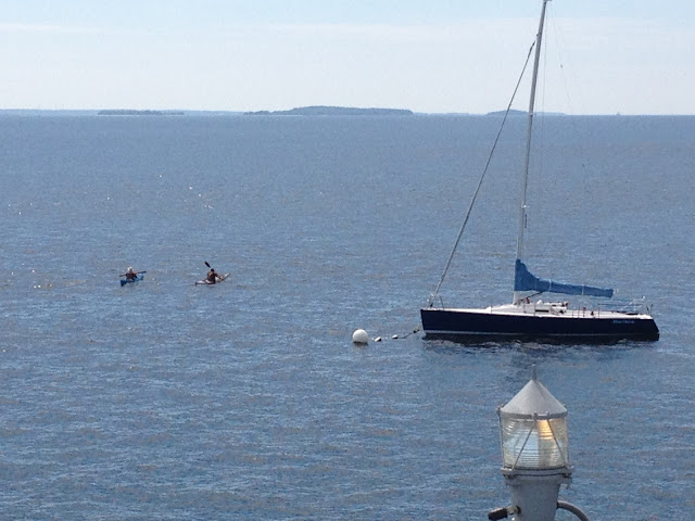
 We followed the shore of Warren Island, where a few campers were arriving in kayaks at the State Park Campground. A short distance away, we paused beside the lighthouse on Grindel Point, took a bearing for Spruce Head and started across West Penobscot Bay. The outgoing current had increased- maybe about 2 knots- and we kept a steep ferry angle to avoid getting swept down-current.


We arrived back at Lincolnville as the ferry once again departed, then drove home drinking iced coffee from Dunkin' Donuts, scheming about getting to the islands we didn't quite reach this time.