Saturday, May 28, 2011

New MITA Islands!

It was the first sunny, clear day we’d had in who knows how long, and I was spending it at my desk at work. I kept thinking “I should get out in the kayak,” but things kept coming up and the day went by like they all do, with me wondering where all the time went. At lunch though, I picked up the mail and found my new 2011 Maine Island Trail Association guide. I had put off renewing my membership... since it required money that I hardly had, but I knew it was worth it.

My trip in the Keys helped me appreciate the importance of MITA. Florida is developing The Florida Circumnavigational Saltwater Paddling Trail, but it is far from a reality. I camped in some not-so-legit spots, and at one I had to clear away the garbage to make room for my tent. And then I wasn’t so sure the surf at high tide wouldn’t force me to climb a mangrove tree to stay dry.


I flipped through the guide book without any expectation of discovering anything new. But there in the Deer Isle section I discovered two additions: small islands, each with a campsite. One is state-owned, one on private land. I won’t divulge their location- you’ll have to get your MITA membership- after all, that’s what makes it possible. In Florida I would have gladly paid the membership price for a couple of dependable places to camp, especially out on some pristine island.


At the end of the day, I rounded-up my gear and headed-out to the nearest new island. I arrived near sunset and set-up my tent in the trees, just above an expanse of granite ledge. I cooked my dinner as the sky grew dark, and watched the lights of Stonington turn bright as I ate. On a distant shore, a campfire flared-up. The air was cool and clear, but it felt like someone had flipped the switch from winter to summer.


In the morning, since I was already out there, I would have a whole other adventure as the fog rolled back in. For the moment though, it was enough to be out on this island. If I’d stayed at home, the evening would have gone predictably enough- probably dominated by a screen with images, words and sound, connecting me to the rest of the world to the point of not knowing where to focus. Instead, I had taken just a small step away- enough for a fresh perspective. Our town looked small and festive against the night. I watched the stars and listened to the waves lap against the granite.

My other living room is a MITA island.

Wednesday, May 25, 2011

Marshall Island

I guided over the weekend. Both days were on the chilly side, a bit foggy and breezy, water temps still down in the mid-forties. We got the clients suited-up in dry suits, and, other than a bit of seasickness, they had a great time. At the beginning of a trip, I sometimes feel a little overwhelmed by all that I would like to show the clients in the few hours we have. But on each trip this weekend, it took only a half-hour of paddling before someone paused, looked around with a huge smile and said, to the effect “ I can’t believe how great this is- I’m doing this again.” That’s when I know why I’m guiding.


As we returned to Old Quarry on Sunday, Nate stood on the shore, leaning over his kayak as he finished packing. I said goodbye to my clients, picked-up my duffel of camping gear and repacked for phase two of the weekend. Nate and I had until Monday night. We’d decided on Marshall Island, a large public island on the east side of Jericho Bay.


Paddling against a mild headwind, we made our way first to Enchanted Island and took a lunch break on the ledges, avoiding the usual beach where several seals were hauled-out. Actually, there were seals everywhere- often mothers with pups following close behind, and it was difficult to avoid them. As we ate our lunch, they occasionally popped their heads from the water nearby and got a good look at us. From Enchanted we made a three-mile crossing over to Three Bush Island, in the lee of Marshall. We thought we would stop there, but a bald eagle sat atop the single bush-like spruce, so we kept moving, following Marshall’s pink granite coastline south.


We paddled in close to shore on gentle seas, weaving in and out of the rocks, occasionally rising or falling on a small wave. The rocks sloped up to a forest interspersed by grassy meadows. A couple of deer perked up when they saw us and bounded away. Gradually, the seas increased and we took more care picking our route until, at Lower Head on the southern end, the swell came unobstructed from the open ocean, occasionally rolling a few bigger waves at the steep pink headlands. If I were writing this with certain publications in mind, I might say the waves rolled toward us like big bowling balls aiming to knock us down, but that really didn’t occur to me at the time. They were really just nice gentle swells. Nate, paddling his new P&H Delphin caught a few beautiful rides. Unfortunately, my waterproof camera isn’t working, so you’ll just have to take my word for it.


We camped at Sand Cove, where there’s a few tent platforms a couple hundred feet up in the woods. Admittedly, I wasn’t eager to leave the boats and lug our gear up into the woods. The idyllic camping spot would be overlooking the beach, right next to my kayak. I like to camp right next to my boat- it serves as animal-proof food locker, gear storage unit, camp furniture... and I like to look out of my tent and see my boat there. But it worked-out fine. Maybe it’s a land trust way of doing things- hiding the traces of man so the island appears unpopulated as you cruise past. We finished dinner late, in the dark, gradually pulling-on all our layers as it grew cool.


According to the MCHT website, at 985 acres, Marshall Island is the "largest undeveloped island on the eastern seaboard" with seven miles of shoreline. We had it all to ourselves. It seemed like a good day for a walk, so off we went, following the trail north through the forest, occasionally popping out atop the rocks where the views took in the south end of the Swans Island archipelago. Dark basalt dikes filled-in cracks in the granite, like the one above, pointing off toward Ringtown Island. The woods were busy with migrating birds and we managed to identify a couple of the more common warblers.

Black & white warbler

Heron Island


We made our way to the north end and walked up the hill for a look at the overgrown airstrip. In the 1980s, the island was owned by developers, who hoped to create an exclusive subdivision, reachable by air or sea. When that didn't work out, the bank auctioned the island to owners who never developed it, finally selling it to MCHT. Of more immediate interest, just west of the airstrip is a freshwater well, with a well-maintained pump.

Ringtown Island


We walked around most of the island, which took us about four hours. By the time we returned to Sand Cove, the wind had picked up out of the south. We paddled along the trails we had hiked only hours earlier, but now the seas had grown- too big for playing in the rocks... and big enough to need to get back across Jericho Bay before the tide turned.

In the lee of Halibut Rocks

Again, we faced a three-mile crossing, but this time we had strong beam wind and waves from the south. A third of the way across, we rested in the lee of Halibut Rocks, then pointed for Phoebe Island. It was wavy out there, with occasional sets of big ones rolling through: dramatic, but not so hard to negotiate with plenty of sweep strokes. I wouldn't have gone out there if we didn't need to, but it helps to be paddling alongside someone you've practiced plenty of rescues with and you know you can count on. At some point, my mindset shifted from vague worry to... a sort of calm satisfaction. Two-thirds of the way across we paused and looked around: steely-grey churning sea, the sky a few shades lighter. We could see waves breaking on Phoebe Island. Isle au Haut cut a distinct profile through the fog; other islands were reduced to distant smudges above the waves.

"Nice," Nate said, and I could only agree.

Monday, April 25, 2011

Fog Island


Nate was up for a paddle yesterday. I hadn't been out since we'd returned from Florida, and honestly, my excitement level was not that great. We'd been in warm weather and water long enough to get used to it, and it seemed like a lot of work to get out in a kayak here. I've been glad to be back in Stonington... sort-of. Okay, I'm lying. We returned home to a pile of bills, we've had some nasty weather, and I've been working to pay for that gas we burned to go south. The Opera House has even been closed for renovations. If you ask people around here how their winter was, they tend to just break down in tears.

But as I got my gear ready, I felt that familiar anticipation. A thick fog hung over the harbor, and as we launched, it began to thin enough to reveal the dark shapes of the nearest islands. We went in and out of rolling fog, out to Steves, and on past Wreck, where just enough swell was coming in to make it interesting among the rocks. It was low tide, and at Round Island we found a series of granite slots where the swells grew into small waves.


I've paddled past this spot so many times, I told Nate, but never quite like this.

"How's that go?" he said. "You can't step into the same river twice?"


True, and it is true of the ocean as well. But I was starting to re-appreciate why I love paddling here so much. It can be drastically different each time. There is always more to discover.

The fog banks lingered in the distance as we followed the shore of McGlathery Island on to Gooseberry. A couple of miles away, Fog Island stood out clear and inviting in the sunshine, so we headed for it. The marine forecast had called for 4-6- foot seas, which unsurprisingly, we didn't encounter in the archipelago, but out beyond Fog, the swell came in bigger, straight from the south. The sunshine went away.

After lunch, we made our way back: Popplestone Ledge, Southern Mark Island, Enchanted Island, Phoebe Island. It seemed we found a different feature at each spot, like challenges in a miniature golf course... except these usually involved steep dumping waves and solid granite. As usual, Nate pushed harder than I did and got his share of rolling and bracing practice. The seals watched from a distance. It started to rain.


Contrast is everything. And here, it often seems like we can get a lot of it in one trip. Fog, rocks and waves, sunshine, rain... the infinite variables that make every paddling excursion unique: I'm missing the sub-tropics a little less than I was two days ago.

Friday, April 15, 2011

Beaches, Bugs & Books: A Leisurely Paddle in the Northern Everglades


The horseflies were biting, but then again, so were the lizards. It was the first afternoon of a six-day paddle around the northern end of Everglades National Park, and we were doing our best to set the tone for a leisurely, relaxing trip. We sat in our lounge chairs on the coarse sand beside the river, reading our books, but there were these distractions: a few bugs and... every time we looked up from reading, those lizards seemed to have moved closer. Definitely, the lizards were moving-in. And they were staring intently at my foot. Before I could blink, one lizard made its move. It darted and attacked. I felt nothing more than a thump against my foot, but the lizard, having retreated to a safe distance a few feet away, had a mouthful of horsefly. The lizard crunched the horsefly in its jaws and gulped it down. Then it cocked its head and looked at me, as if to say “got any more?”


This would be our last trip in the Everglades before heading home. We wanted to camp in a few places we hadn’t been, and get in some beach time before getting back to our usual life. Our route would take us on a loop starting with a few days on the inside, followed by a meander among the Ten Thousand Islands.


We paddled up the Lopez River, spent the first night there, and followed the familiar markers through inland bays for much of the second day’s paddle. We spent our second night at the Sweetwater Chickee. We’d been in Florida for nearly two months, and that afternoon experienced rain for the third time. As long as the thunder and lightning stay in the distance, a chickee is a nice place to be for a storm. You’ve got a roof over your head and a good vantage point to watch the dramatic clouds sweep past.


We headed down the Chatham River and then camped on beaches in the Ten Thousand Islands: New Turkey Key, Pavilion Key and Tiger Key. We were pretty relaxed about it, favoring quality time on the islands over mileage. The days were getting hotter- in the high eighties, and each afternoon a line of dramatic clouds swept in from the mainland, threatening thunderstorms, but never shedding more than a few drops of rain. We spent a lot of time walking around and looking at things: shells, trees, birds, the distant line of the horizon over the Gulf.


There were others camped at Pavilion Key, and we met some. They were there for a rendezvous of the Water Tribe- the group responsible for the Everglades Challenge race from St. Petersburg to Key Largo in sea kayaks and various other small, non-motorized craft. These were just about the first real sea kayaks we'd seen during our entire time in Florida. They even wear life jackets and sprayskirts.


On our last evening at Tiger Key, we sat on the beach, consciously savoring our last sunset over the Gulf. It was hard to leave, and really, we could have stayed longer. It cost very little to be there, but the meter kept ticking on our home in Maine, and we would be returning to a pile of bills and responsibilities. But we told ourselves we were returning to a good place, and we missed the solid granite of our islands. We would need to return home with an increased resolve to make the most of it, to enjoy it as if we were only visitors. Which, any way you look at it, is ultimately the case.


I awoke before sunrise to see the horizon blurred by fog. We haven’t seen much fog in Florida, so it felt like a sneak preview of Maine. The air and the sea were still and quiet. I went out for a photo and the no see-ums descended, my skin burning with their bites. I dove back into the tent and waited for sun and wind to drive the bugs away. It’s worth mentioning that the bugs were always a presence, but usually, as long as we got our cooking done before dusk, we could wait-out the worst swarms inside the tent. Our last morning there was the one exception. We needed to launch in time to avoid paddling against the current, so we packed quickly, skipping our oatmeal, enduring the bugs until we were on the water where a breeze kept them away.


After a few hours of paddling we were back in Everglades City. Two days later we were back in Stonington amid a heavy rainstorm, our tans beginning to fade, the itch of bug bites subsiding, all of it already feeling distant and dreamlike. But the next morning as the sun sparkled on the water between Stonington Harbor and Isle au Haut, those familiar islands- all granite and spruce- looked very solid.

Monday, March 28, 2011

Boca Chita Key to Key West: A Few Snapshots


I sat beside the lighthouse, watching the sun set between a nuclear power plant and a small mountain made of garbage. Eight miles of Biscayne Bay lay between me and that silhouetted shoreline where I’d begun paddling that morning after launching from Biscayne National Park headquarters. I’d followed the wild, mangrove shoreline north a few miles toward Miami, before taking an abrupt right turn across the bay. A couple of hours later, I could see the lighthouse on Boca Chita Key. I paddled toward it.

I was at the start of a trip I’d been dreaming about. I’d read as much as I could, and stared at the charts for hours on end, trying to anticiapate what I would find in each area: where to camp, the dangers and the sights, how the currents flow. I wanted to paddle the entire chain of the Florida Keys, north to south, a distance of about 150 miles, and since Rebecca was busy with her artist’s residency in Everglades National Park, I would do it solo.


I’d visualized that first day’s crossing for too long. I’d gone to the park headquarters and looked across. From the second story I could see the dim outline of Elliot Key across the bay, but from kayak height, all I could see was that aqua-turquoisey water surface stretching away to infinity. There were vast shallow areas that were a hazard to go around, but also a refuge from larger boats. I had my gear ready for a couple of days before the winds let-up enough to go for it. All that fretting paid-off; I followed my bearings exactly to the markers and found my way across without a hitch. That night at Boca Chita Key I sat in the dark, gazing at the city lights, savoring even the power plant, which would be a constant landmark for the next couple of days.

I established my routine by the third day: get up in the dark, launch at sunrise, and paddle 21 to 24 miles to my next campsite. I got a little lost in Jones Lagoon, a shallow patch of mangroves encased in islands; maybe not a good idea with a full day ahead, but I’ve started to enjoy the contrast between ocean paddling and poking around skinny water and overgrown passages. Later, I passed the exclusive Ocean Reef Club, a gated community that takes up the entire northern end of Key Largo. It was a fitting welcome to the populated portion of the Keys: huge houses with huge powerboats coming and going from the canals. The club emanated a constant din of children’s voices, splashing and distant motors. I drifted in among a family on short kayaks, the wife admitting nervousness about the channel up ahead, where someone’s personal mini cruise ship was motoring in. The husband snapped at her while the kids drifted into the wake of the large boat. I half-expected that, at any moment, someone would point at me and shriek, like in “Invasion of the Body Snatchers”, revealing the intruder in their midst. It was a feeling that would linger. The surprising thing though- and I found this throughout the Keys, was that, just beyond such a heavily-developed area, the mangroves began, and for the rest of that day I passed only a handful of houses before I found a campsite on an island.


The next day, to avoid some of the wind, I headed into Largo Sound and rode the current through the Adams Cut to the bay side. Here, I passed beneath Route One, which would be a presence all the way to Key West. For a few moments, I had a hint of what road-based visitors to the Keys experience: the hum of traffic, a billboard advertising a fireworks shop, and oh, by the way- it’s all for sale.

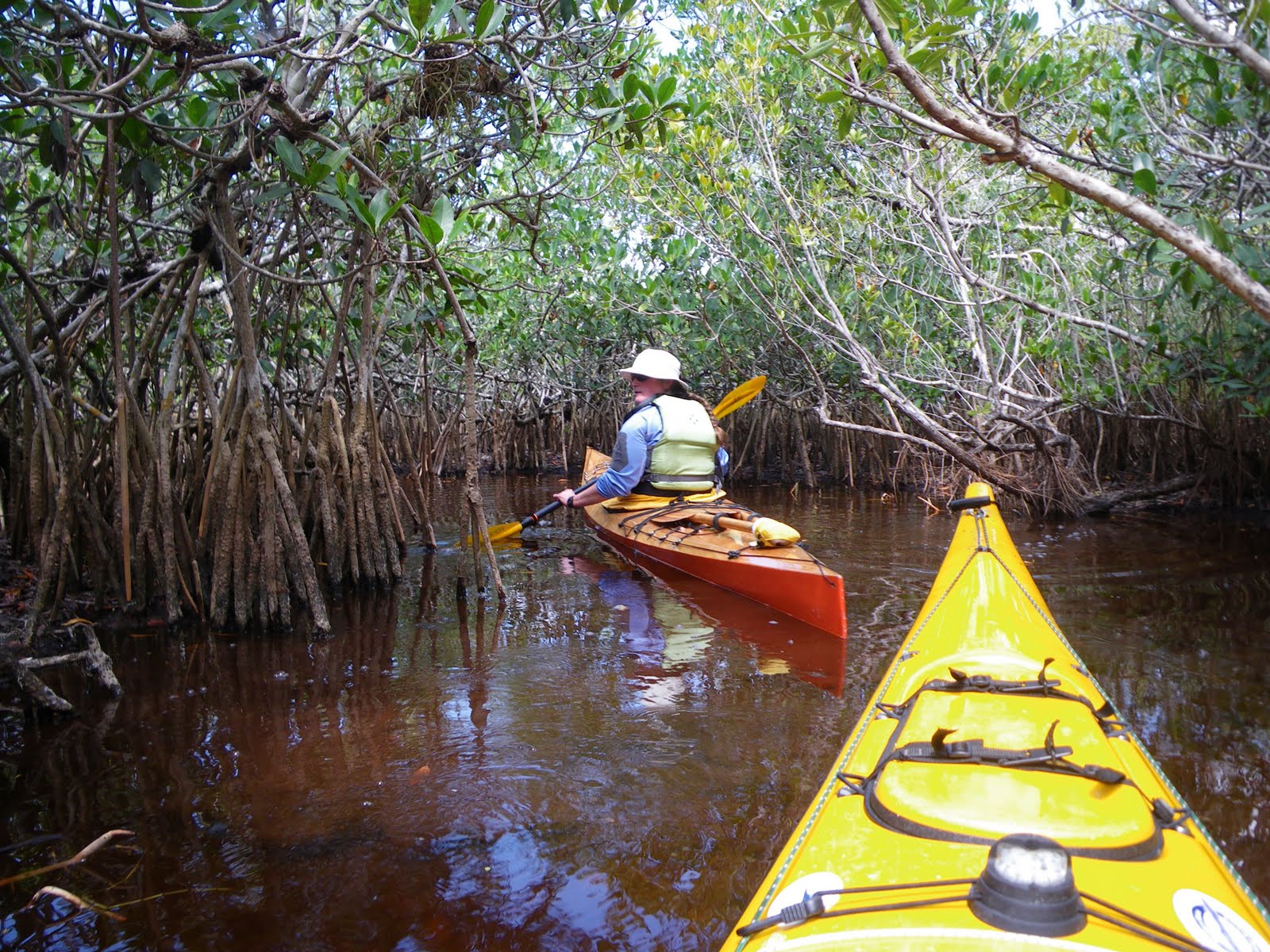
But the antidote is a short paddle away. Just off of Dusenbury Creek, I went into a section of mangrove tunnels called “The Grottoes”. There, in the leaf-filtered sunlight among the gothically arching prop roots, I found a stretch of calm, quiet water- a temporary respite before following the remaining, mostly built-up Key Largo coastline.


Later in the afternoon, I rode the current in Tavernier Creek back to the ocean side, and found another campsite that I shared with some wood rats. I woke a couple of times to discover one of the rats crawling up the mosquito netting above my head. It’s also worth mentioning that at these less-established, not so legit campsites, I tend to watch the rising tide with a little anxiousness. After all, it’s the full moon- just how how high will the water rise?

Plantation Key, Windley Key, Upper Matecumbe Key... private homes, motels & resorts, boat rentals, helicopter rides... One mile after another, I paddled, keeping the Keys on my right. As the day wore on the waterfront crowded with more people: couples in lounge chairs staring out at the sea, kids, spring-breakers... bikinis, drinks, big fishing rods, short plastic boats. Kiteboarders zipping out across the waves, occasionally taking to the air. It unrolled on my right as I paddled past, all entertainment for the solitary paddler. Ate lunch on Indian Key, walking the paths among the ruins of a former town.

By now, I’d become accustomed to sharks and rays passing beneath. At first I noticed small sharks in shallows, and occasionally some larger ones that circled around indifferently below. The rays undulated gracefully, taking-off abruptly when I approached.


One of the best deals for the paddler in the Keys are the primitive sites at Long Key State Park, which are held each day specifically for kayakers arriving by sea. Eight bucks gets you a sheltered platform with a picnic table, bathrooms and an outdoor shower... which you’ll need if you arrive at low tide, as I did. It’s a long, muddy carry. That night I sat and sipped my tea with the sea lapping calmly just below, sparkling beneath a full moon. Before dawn, one cruise ship after another hummed past on the horizon, headed for Key West.

The weather forecast for my sixth paddling day called for northeast winds picking-up in the afternoon. It also happened to be a day that would take me across some fairly open water south of some long bridge spans. The tide flows between the bay side and the ocean, squeezing through the gaps to create some strong currents and potentially dicey paddling, especially if the wind works against those currents. I’d begun thinking of the Seven Mile Bridge as the crux of the trip, potentially the most difficult section. If I made it that far, I ought to make it to Key West.

I made the Long Key Viaduct crossing first thing and progressed until mid-morning, when the wind increased, pushing me along, one hotel beach after another, guests looking up to see me surf past, until ahead lay a three-mile open stretch: the Vaca Key Bight. I tethered my paddle to my wrist, and headed across. It was a bit rough, but not rough enough to call it a day.

At the end of Boot Key, the Seven-Mile Bridge stretched away to the horizon with no end in sight. I could see my destination though: Molasses Key, where I would camp, over four miles away. I had little sense of what conditions lay ahead, so I plunged ahead, and it got rough. The waves behind me grew, and soon I became sadly aware of my kayak’s limitations. The boat was heavily-loaded, with over four gallons of drinking water in the cockpit. I was riding a little low. It’s one thing to ride waves in a following sea, but another when those waves start slipping over the coaming, pooling in the lap of my sprayskirt, slowly filling the cockpit. There wasn’t much I could do about it. With one hand I’d pull the skirt up and get the water out, but within a minute I had another gallon of water in my lap. I watched the bridge to gauge my progress. A large sea turtle surfaced and gazed at me for a moment before disappearing below, into its element. I could feel the added water in the boat making it less responsive. Somewhere in the middle, where the current was probably greatest, I found myself in a mogul field of waves. I focused on staying upright; forward progress was a luxury I could hardly think about.

But I got through it. I stayed focused on Molasses Key. Behind it, more land became visible, and eventually I could make out individual trees, and then I passed into a shallow area. I took a long drink of water and rested before paddling in to find my campsite.

I stayed on Molasses Key for two nights. As promised, the wind continued to pick-up: 25, 30-knot gusts. Thunderstorms threatened, mountains of high clouds building and passing by. A couple of powerboats anchored offshore, but the people in them never waded-in. I finished my serious book before lunch and began on the thriller. I made coffee and strolled around the small island, walking out over the ancient coral, surveying my little world from different angles. The wind hissed through the trees, weaving its sound with the flow of traffic on the bridge, a mile away. A double semi-truck of Coca-Cola heads for Key West, followed shortly by an identical red truck heading north. I’d watch the bridge and just space-out, finally breaking free, as if from hypnosis.

Maybe the isolation on Molasses Key was responsible for my choice to head to a KOA Kampground for my last night. After another long day of dodging the wind, I got into somewhat sheltered water and the usual pattern of overly-developed stretches alternating with wild mangroves. I was tired, and the prospect of a hot shower, dinner at a restaurant, a swim and a soak in a hot tub sounded good. Besides, the camera and cell phone batteries were almost shot.

Shortly after arriving, I wished that I’d just gone to the primitive site and stayed in my own, unshowered world. “It’s quiet compared to last week,” people told me, since spring break was winding-down. But it still felt like a tailgate party where the main attraction is warmth. A nearby trailer cranked classic hits all afternoon (which I found myself enjoying) and the shirtless guys with bandannas on their heads stood around with tightly gripped beers over their bellies, comparing tattoos or sunburns. I had a talk with a nice guy who really just wanted to talk about his hometown in Illinois, and when he finally figured out that I’d paddled there in that kayak, offered me a marguerita. Sorry, no, don’t drink, I had to say, as if confirming that I truly was from a different planet.

Freedom lay just beyond the mangroves, but few could see it. I slipped out quietly before sunrise and paddled the rest of the way to Key West. I got to the end of the island and turned back, waiting for Rebecca at the Southernmost Point, a large painted buoy on shore, where visitors took turns having their picture taken. There is nowhere to land nearby, so I drifted in the small waves, watching occasional person-sized sharks swim by below, until finally Rebecca appeared at the fence and waved. It was my turn for a picture.

9 days (1 weather day) 8 nights, about 157 nautical miles.

Friday, March 11, 2011

Hangin' With The Spoonbills

Just east of Flamingo is a large, shallow bay. Five miles across, the bay gently curves about two miles into the Snake Bight area before dipping into another bight. It’s a popular spot for birds, maybe because it is only a foot or two deep, leaving the fish and crabs little room to hide. Huge flocks like to congregate on the exposed mud flats, and in the branches of mangroves along its banks.


On our first foray into the bight, we paddled-in at high tide and ran out of water. The tides and the muddy bottom are hard to predict around here. One foot of water on the chart might really be four inches or none at all if the wind is blowing the water away, or if the mud has shifted. We paddled-out quickly, not wanting to end-up slogging through the mud on foot.

For our second excursion into the bight, we followed the straight line of a man-made channel into the bight. It doesn’t look like exciting kayaking, but it’s nice to be able to dig your paddle into water, rather than mud. Every hundred yards or so stood a marker with a bird on top: anhingas, laughing gulls, the occasional osprey that took off, skimming the water surface with its claws. Small fish jumped from the water again and again. In the distance, a fisherman stood on a lone skiff, poled by a man standing atop a platform. Flocks of wading birds massed in the shallows and mud flats.


At the end of the channel, we paddled around a stand of mangroves with bird poop-speckled leaves, and that unmistakeable aroma of birdly domesticity. We saw ibises and egrets and such- the usual suspects for this area. Wonderful to see, of course, but also visible along just about any canal in southern Florida. We beached ourselves in the mud for an in-the-cockpit lunch break.


As we sat quietly, we noticed a flash of pink feathers in the mangroves up ahead, and then another. A moment later, several of the birds flew out around us, winging around in a circle before settling again into the mangrove branches: roseate spoonbills.


A little over a hundred years ago, it had become fashionable for women to wear feathers or entire wings on their heads. (“Excuse me Miss, but you have a dead bird on your head”). Plume hunters in the Everglades and Florida Bay killed as many birds as they could, making obscene profits until, predictably, the birds began to disappear. The roseate spoonbill has the fortune- or misfortune in this case- to have bright pink feathers. By the 1930s, the species was hunted almost to extinction, down to only a few birds in Florida.

We finished our lunch and drifted quietly past a bend where dozens of the birds were perched atop the mangrove foliage. They are strange-looking birds to be sure. They get our attention with those bright pink feathers, but the spoon-shaped bill seems like a remnant from a prehistoric age, or a cruel joke played by nature. I’m sure we look funny to them too, but they didn’t seem to mind us drifting by at a distance.


It’s funny how we feel lucky to see one species of bird more than another. Is it because we don’t see pink birds very often? Or the unusual bill? Or maybe it’s because we nearly lost the chance to see these birds ever again. Either way, the spoonbills held our attention for a long time, until it started getting late and we headed back to Flamingo, pointing our bows into the sunset.


Friday, March 4, 2011

Greetings from the Everglades


From the road, all one sees is a pool of dark, shallow water beneath a canopy of thick foliage. It goes back maybe fifty feet before disappearing around a bend, if not disappearing altogether, but the presence of other parked cars suggests that maybe this trickle of muddy water actually leads somewhere. This is the beginning of the Hell’s Bay Canoe Trail, a marked route through the Everglades leading to the Hell’s Bay Chickee. Rebecca and I were headed out for the next two nights.


Our paddles churned up the muck, coloring the water to a black bean soup hue. We got around that first bend- a very tight turn- and the liquid path continued, one turn after another. We passed through numerous mangrove tunnels, often six or eight feet wide, with only inches of water beneath our hulls. And then we’d burst into an open area where the grasses and palms hissed in the wind- wind that mostly passed overhead. This is a good spot to paddle on a windy day. We’d had plans for a more ambitious four-night trip around Cape Sable and Whitewater Bay, but the forecast called for strong winds that would have made the paddling a chore at best.


We had been in Everglades National Park for a week. Rebecca is the Artist in Residence, which basically means the park gives her a residence and... yes, she’s the artist in that residence. After about three weeks here last year, we saw so much potential- paddling-wise, and art-wise, that we knew we had to come back and spend even more time. Rebecca’s focus is on painting, drawing and printmaking, but our kayaks get us out to places that relatively few people get to, let alone artists.


The Everglades is an often-misunderstood place. For generations, it was seen as a wet wasteland, useful only if it could be drained. Against all odds, it was drained. It’s a long, convoluted tale of human-centric folly, and at one point it seemed that the Everglades chapter was near its end, with entire species of plants and animals on the verge of extinction. Most of the national parks were established to protect places of grand, obvious beauty, easily seen and appreciated by their visitors. The attraction of the Everglades is subtler than other parks. Everglades National Park was the first of its kind, established to protect a threatened ecosystem, which might not be so tangible from the driver’s seat of an RV. Even from the cockpit of a kayak, it takes some effort to see the big picture.


You could say that the Everglades has a PR problem. And it isn’t because alligators aren’t cute.

After a couple hours of following a twisting watery path, we emerged into a series of small bays, arriving at the Pearl Bay Chickee in late afternoon. A chickee is a platform built on stilts above the water. There’s an outhouse and a roof with just enough room to camp. It’s also a pleasant place to while away what’s left of a sunny afternoon: reading, painting, enjoying the luxury of a hot cup of tea in the wilderness.


We ate dinner as the sun set, finally retreating into the mosquito netting shell of our tent, where we listened to lapping waves and the occasional splash of a fish or a wading bird. In the east, Miami lit the eastern horizon. a pinkish glow that was beautiful in its own way, even if it is a constant reminder of the human sprawl that nearly rendered this place obsolete.


It’s hard to describe our next day’s activities without useing the phrase “hanging-out”. That’s just what you do on a chickee. There’s nowhere to walk, but the twenty or so feet to the outhouse. Sure, we could get into the kayaks and do some exploring, but the view from the platform feels like a privledged one, and an unusual perspective for Rebecca to paint from. We watched birds, and an otter that, of all the little mangrove coves for miles around, chose ours to hunt for its breakfast.


Finally, we packed-up and paddled another couple of hours to get to the Lane Bay Chickee. Here we left the established canoe trail and struck off to navigate for ourselves, finding passages between mahogany and cypress hammocks and mangrove-lined bays. The navigating is a bit imprecise, with the chart only generally representing what we see. Often, an “island” is really a group of mangrove trees that probably weren’t even there when the chart was last updated. Still, it’s all we have to navigate by, so we follow along carefully, and try not to panic when nothing seems to look as it should. Aside from tricky navigating, our mileage would have been that of a short day paddle at home, but that’s okay; it gave us plenty of time on the chickee, which, after all, is why we’re here.